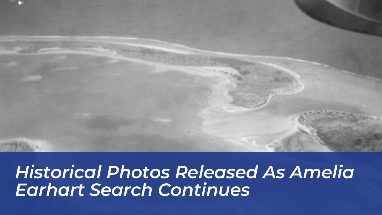

The Air Force Museum of New Zealand has released a historical collection of 47 high-resolution aerial photographs of Nikumaroro atoll. These images provide new visual evidence for researchers investigating the July 2, 1937, disappearance of pioneering aviator Amelia Earhart and navigator Fred Noonan.
The black-and-white images were captured on December 1, 1938, during a New Zealand military aerial survey aimed at identifying suitable airbase locations across remote South Pacific islands. Published in full digital high-resolution on the museum’s website following increased public interest, the photos offer a detailed look at the island-then known as Gardner Island-just 18 months after Earhart’s twin-engine Lockheed Model 10-E Electra went missing.
Discovery of the 1938 Aerial Survey Images
The original photographic negatives were located more than a decade ago by Matthew O’Sullivan, the keeper of photographs at the Air Force Museum of New Zealand in Christchurch. Taken from an amphibious biplane, the full photographic set provides a comprehensive visual survey of Nikumaroro’s coastline, reef perimeter, and central lagoon before significant human settlement took place.
Prominent Earhart researcher Ric Gillespie characterized the photographic set as a critical resource for ongoing research. Because the images show the atoll’s landscape shortly after Earhart’s disappearance, analysts are examining the photos for environmental changes, shifting coastlines, or potential physical signs of aircraft debris along the flat western reef and surrounding shoreline.
The Nikumaroro Hypothesis and Historical Context
Nikumaroro, an uninhabited coral atoll in the Phoenix Islands that forms part of the Republic of Kiribati, is central to the “Nikumaroro hypothesis.” This theory suggests that Earhart and Noonan, unable to locate their intended refueling stop at Howland Island, redirected south along a radio navigation line and made an emergency landing on the exposed reef flat during low tide.
Proponents of the hypothesis argue that Earhart and Noonan survived as castaways for a period, collecting rainwater and surviving on local fauna. Past archaeological visits to the island have uncovered several artifacts, including bone fragments, remnants of a campfire, and pieces of glass believed to match a 1930s cosmetic cream jar.
Purdue Expedition Focuses on the “Taraia Object”
The release of the historic photos coincides with an active field expedition on Nikumaroro led by researchers from Purdue University, the Purdue Research Foundation, and the Archaeological Legacy Institute (ALI). Purdue University holds a deep historical connection to the aviator: through the Amelia Earhart Fund for Aeronautical Research, the Purdue Research Foundation financed the purchase of the Lockheed Electra “Flying Laboratory” in 1936.
Led by Rick Pettigrew, executive director of ALI, the 17-person expedition team arrived aboard the vessel Marin Mainiku following an 830-nautical-mile voyage from Tarawa. The primary objective of the field operation is to investigate the “Taraia Object,” an elongated visual feature detected in a 2020 satellite image inside the atoll’s lagoon near the Taraia Peninsula.
Field operations involve both land and maritime archaeology techniques, including:
- Terrestrial Reconnaissance: Clearing jungle paths-such as the historic “Gallagher Highway”-and clearing sand spits to inspect for surface artifacts.
- Magnetometer Surveys: Detecting potential ferrous metal components from the Electra’s control systems and engines.
- Sonar and Hydroprobe Testing: Scanning lagoon sediment and probing subsurface structures to determine composition and depth.
- Water Induction Dredging: Carefully removing sediment layers to allow direct visual identification of submerged anomalies.
Major Earhart Search Hypotheses
Over the eight decades following the disappearance of Earhart’s flight, several primary theories have driven research and physical search expeditions across the Pacific Ocean.
| Theory Name | Primary Hypothesis | Key Evidence / Focus Areas |
|---|---|---|
| Crash and Sink | The Electra ran out of fuel and crashed directly into the open ocean near Howland Island. | Deep-sea sonar mapping, high-resolution bathymetric scans of the ocean floor surrounding Howland Island. |
| Nikumaroro Castaway | The aircraft landed on Nikumaroro’s reef flat; the crew survived temporarily as castaways. | 1938 survey photos, improvised campsite artifacts, cosmetics jar fragments, and the “Taraia Object” lagoon anomaly. |
| Northern Route / Capture | The plane flew toward the Marshall Islands or Saipan and was intercepted. | Unverified post-war eyewitness accounts and regional hearsay; widely discounted by mainstream historians. |
Current Field Conditions and Next Steps
Fieldwork on Nikumaroro remains subject to extreme weather and challenging Pacific sea conditions driven by El Niño patterns. The search team reported minor operational delays due to heavy tropical weather but confirmed that fieldwork plans and sonar mapping activities are progressing.
While preliminary checks of the newly released 1938 aerial images have not revealed immediate visible structures in the specific area of the Taraia Object, researchers and independent analysts continue to digitize, clean, and cross-reference the historical survey set against modern satellite models.