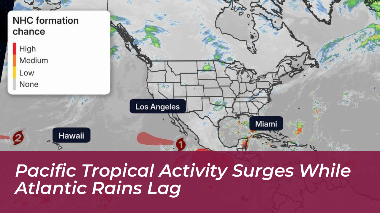
Tropical activity remained very high in the Pacific Ocean, marked by storms such as Hurricanes Nolo and Rachel. Meanwhile, the Atlantic basin continued an unusually quiet streak. Meteorological data shows that the Eastern Pacific region had a much more active season than average. This surge was driven by climate patterns and warm ocean waters.
Conversely, atmospheric conditions across the Atlantic basin suppressed major storm development. This kept seasonal output at historically low levels. Strong wind shear and expansive plumes of dry air were the primary drivers suppressing Atlantic cyclone activity.
The Contrast Between Pacific and Atlantic Basins
The stark difference between the two ocean basins captured the attention of meteorologists worldwide. While the Eastern Pacific teemed with continuous storm generation, the Atlantic struggled to sustain even basic tropical organization. Experts pointed to a powerful El Niño cycle as a main reason behind this geographic imbalance.
El Niño events typically create ideal conditions for tropical systems in the eastern and central Pacific. At the same time, they introduce hostile conditions to the Atlantic. These conditions include warmer sea-surface temperatures in the Pacific and much lower vertical wind shear. This allows developing storms to organize and intensify rapidly without disruption.
Key Factors Fueling the Pacific Surge
- An early and powerful onset of the El Niño climate pattern.
- Sea-surface temperatures well above historical averages across the Eastern Pacific.
- Notably low vertical wind shear, providing ideal stability for cyclone formation.
- Multiple named systems capable of developing simultaneously over open waters.
Why the Atlantic Season Remained Suppressed
Across the Atlantic basin, a mix of inhibitive environmental elements kept hurricane numbers near historic lows. Wind shear-defined as differences in wind speed and direction at varying altitudes-created adverse conditions. These conditions routinely disrupted mature tropical cyclones and prevented emerging systems from organizing.
Additionally, broad areas of dry air, Saharan dust plumes, and persistent atmospheric stability stifled potential storm growth through the peak months of the season. Even as minor disturbances attempted to form near the Gulf Coast and southwestern Atlantic, hostile upper-level winds quickly dismantled them before they could reach major intensity.
Inhibitive Atlantic Conditions
- Strong vertical wind shear tearing apart developing low-pressure systems.
- Expansive plumes of dry air and Saharan dust inhibiting deep convection.
- Persistent atmospheric stability suppressing widespread cloud organization.
Meteorological Outlook and Historical Context
Weather experts continue to monitor both basins closely for late-season shifts. Historical records indicate that an inactive start in the Atlantic does not completely guarantee a quiet finish. However, structural atmospheric barriers posed a formidable challenge to storm creation. Meanwhile, Pacific meteorologists track ongoing threats remaining safely offshore or passing well south of island archipelagos. This keeps coastal communities vigilant as global weather patterns continue to evolve.