
San Antonio is set for a dramatic weather shift. A strong cold front is sweeping through South-Central Texas, ending a stretch of abnormally hot October weather with gusty winds, brief rain, and significantly cooler temperatures.
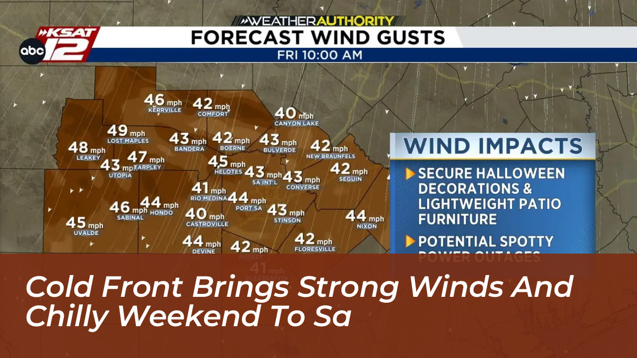
According to the National Weather Service in Austin/San Antonio, the front arrives ahead of dawn. It brings northerly winds with gusts reaching 40 to 50 mph. Local meteorologists report that San Antonio carries about a 30% chance of brief rain from roughly 3 a.m. to 10 a.m. However, overall rainfall totals will remain light at less than a tenth of an inch.
Wind Advisories and Potential Impacts
The National Weather Service has issued a wind advisory for South and Central Texas, effective from 4 a.m. through 7 p.m. Sustained winds are expected to climb to around 25 mph by the morning hours. Periodic gusts will push up to 45 or 50 mph.
City officials and local safety agencies advise residents to secure lightweight patio furniture, trash cans, and outdoor Halloween decorations before the peak winds arrive. The high gusts also carry the potential to knock loose tree branches into power lines. This creates a risk of spotty, localized power outages across the metro area.
Steep Temperature Drop Into the 40s
San Antonians have experienced average high temperatures near 91 degrees over the previous ten days. Now, they will see a stark contrast. Temperatures will hover in the mid-60s through much of the morning, rising only slightly into the upper 60s by the afternoon.
Attendees heading to Friday night high school football games should bring jackets. Kickoff temperatures will start in the lower 60s before sliding into the 50s during the second half. Overnight lows are projected to plunge into the upper 40s across the San Antonio metro area. This marks the coldest air the city has recorded since April 19.
Rural areas and the Texas Hill Country will experience even chillier conditions. Locations such as Kerrville and Fredericksburg are expected to bottom out in the lower 40s. Stiff wind chills will make the air feel closer to the freezing mark in the mid-30s.
Chilly and Clear Weekend Forecast
The cooler air mass will linger throughout the weekend, providing ideal autumn weather for outdoor activities. Saturday will feature mostly sunny skies and high temperatures topping out in the upper 60s. Meanwhile, winds will gradually decrease to a manageable 10 to 15 mph.
A similarly cold night is expected heading into Sunday morning. Predawn lows will once again dip into the upper 40s in San Antonio, and 40 to 42 degrees across the Hill Country. Sunshine will help temperatures rebound into the lower to mid-70s by Sunday afternoon.
A gradual warming trend will begin on Monday. This trend will push daytime highs back into the upper 70s and return them to the mid-80s by the middle of next week. No significant chances of rain are forecast for the region until at least the following weekend.