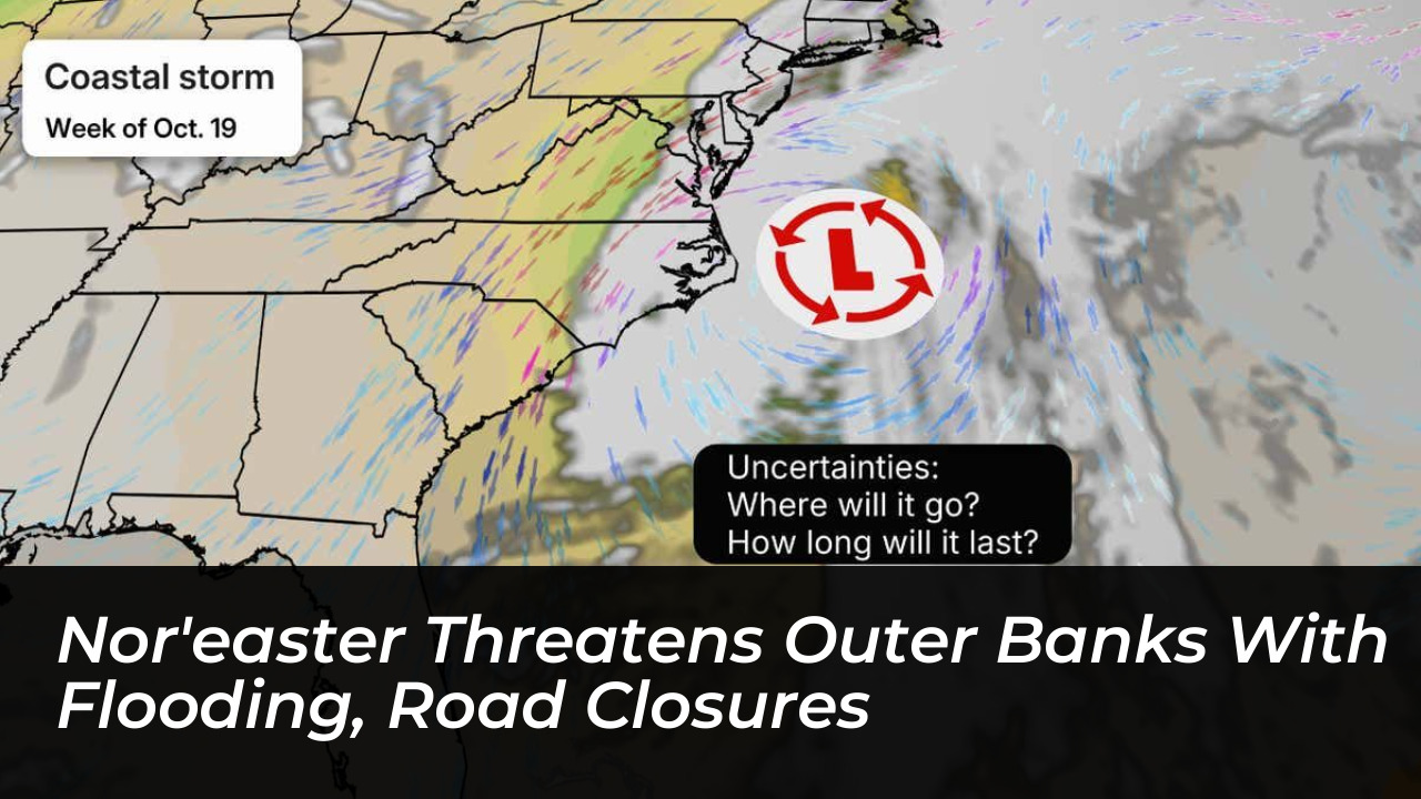

A developing nor’easter is threatening North Carolina’s Outer Banks with several days of coastal flooding, strong winds, and dangerous surf. The storm prompted evacuation warnings and emergency road protection measures starting Saturday, October 17, 2026. Dare County officials ordered visitors to leave Hatteras Island as forecasters warned that rising water and repeated ocean overwash could severely disrupt transportation well into the following week.
The National Weather Service (NWS) Newport/Morehead City office issued a coastal flood warning beginning Saturday afternoon and extending through Tuesday. Forecasters project water levels reaching up to 2 to 4 feet above ground level in vulnerable areas. Breaking waves of 8 to 14 feet and wind gusts exceeding 50 mph are expected to worsen coastal erosion and threaten roads and coastal properties across the region.
Mandatory Evacuations and State of Emergency
Dare County declared a state of emergency for Hatteras Island at 6:00 p.m. Friday, followed by a mandatory evacuation order for visitors starting at 8:00 p.m. The evacuation directive encompasses all villages on Hatteras Island, including Rodanthe, Waves, Salvo, Avon, Buxton, Frisco, and Hatteras. No evacuation orders have been issued for permanent residents of Hatteras Island, Ocracoke, or areas north of Oregon Inlet.
Emergency management officials noted that this mandatory evacuation order is an unusual precaution for a nor’easter, as such orders are typically reserved for tropical systems and hurricanes. The NWS emphasized that Saturday represented a critical window for travelers to safely exit Hatteras and Ocracoke islands before deteriorating conditions rendered local roadways impassable.
N.C. Highway 12 Reinforcements and Travel Disruptions
By 11:30 a.m. Saturday, North Carolina Department of Transportation (NCDOT) crews were actively reinforcing dunes along N.C. Highway 12 at Pea Island, north of Hatteras Island. Heavy equipment moved sand into protective barriers near the Canal Zone, situated just south of the Marc Basnight Bridge, to help shield the highway from anticipated ocean overwash during high tide cycles.
- High Tides of Concern: The most significant oceanside flooding impacts are projected during the high tide cycles on Sunday and Monday.
- Wind Advisories: North to northeast wind gusts of 45 to 55 mph are expected to persist across the Outer Banks through at least Monday.
- Marine Conditions: Offshore waters face severe warnings with wave heights projected between 15 and 20 feet near Diamond Shoals and Cape Hatteras.
- Ferry Services: Hatteras and Ocracoke ferry operations face potential delays or suspensions as rough sound and coastal waters build.
National Park Service Closures and Local Impacts
The National Park Service announced weather-related closures across Cape Hatteras National Seashore, Fort Raleigh National Historic Site, and Wright Brothers National Memorial. Campgrounds, off-road vehicle ramps, and visitor facilities were scheduled to close by noon Saturday.
Park officials also raised concerns regarding structurally compromised oceanfront houses in Rodanthe, which remain highly vulnerable to collapse amid heavy surf and severe beach erosion. Residents and visitors across eastern North Carolina are advised to monitor official updates through DriveNC.gov and the National Weather Service before attempting any travel through early next week.