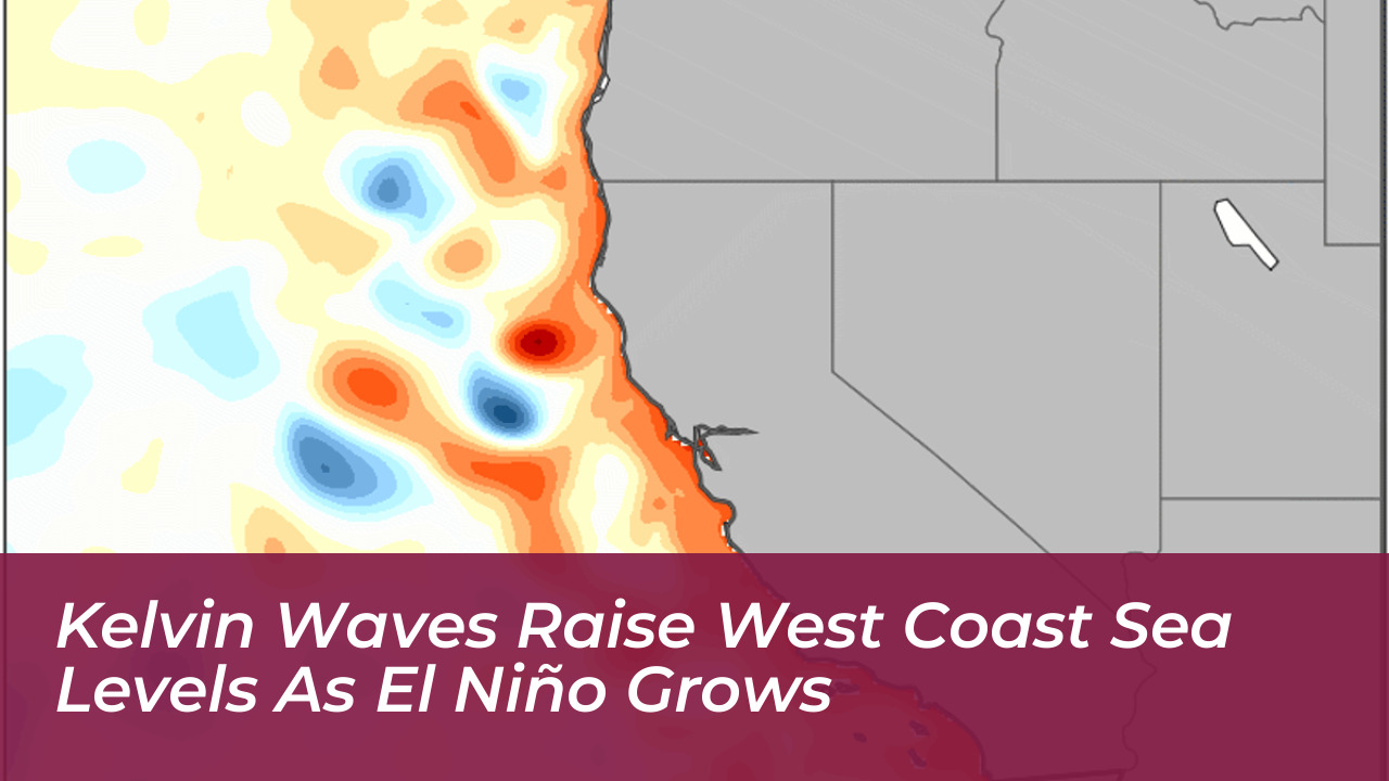

Rising Pacific Ocean waters are increasing coastal flood risks along the U.S. West Coast as a strong El Niño develops. Large-scale ocean disturbances known as Kelvin waves have raised sea levels by about six to eight inches in Southern California, according to Dillon Amaya, an atmospheric sciences professor at North Carolina State University.
Unlike tsunamis or waves surfers catch at the beach, Kelvin waves move slowly beneath the ocean surface. These planetary-scale pulses of warm water travel thousands of miles across the equatorial Pacific before reaching South America, where they split and move north along the North American West Coast and south toward Chile.
The Science Behind Kelvin Waves and El Niño
Kelvin waves serve as a primary symptom and mechanism of El Niño events. Normally, strong trade winds blow from east to west, pushing warm water across the equatorial Pacific toward Asia. However, as tropical waters warm, high pressure breaks down and trade winds weaken or reverse.
This wind shift causes massive volumes of warm water to move eastward. According to Josh Willis, project scientist for sea level missions at NASA’s Jet Propulsion Laboratory, Kelvin waves act like the heartbeat of El Niño. They transfer heat from west to east, thickening the upper warm layer of the ocean while depressing the colder thermocline below.
As these subsurface pulses travel along the coast at roughly 6 miles per hour-or about 150 miles per day-they act like a wave moving around a sports stadium. The disturbance displaces cold water and raises local sea levels by several inches to over a foot.
Amplified Coastal Flooding and Erosion Risks
While Kelvin waves by themselves do not present a direct threat to beachgoers, their gradual rise in sea levels significantly increases the vulnerability of coastal communities during storms or exceptionally high tides. The effects became apparent in Southern California when Tropical Storm Rachel brought storm surges into coastal neighborhoods, partially submerging oceanfront homes due to the compounded elevated sea levels.
Experts note that the total rise along the coast is driven by multiple overlapping factors:
- Subsurface Kelvin Waves: Temporarily lift the ocean baseline by 6 to 12 inches.
- Thermal Expansion: Unusually warm Pacific waters expand, adding another 6 to 10 inches of height.
- Long-Term Climate Change: Permanent baseline rises of about 8 inches since the 1890s along locations like San Francisco.
- Seasonal Events: Winter storms, large Pacific swells, and natural king tides that can coincide with elevated water levels.
When high tides and storm surges ride on top of an already elevated ocean baseline, incoming water reaches farther inland. This increases overtopping risks for roads, low-lying properties, and aging coastal infrastructure such as patchwork levees and seawalls.
Duration and Regional Preparedness
During an active El Niño year, up to six Kelvin waves can occur sequentially. Their temporary high-sea effects can last from weeks to more than a month per pulse, potentially sustaining elevated coastal hazards through the winter and into the following spring.
State and federal agencies are actively tracking the progression of coastal Kelvin waves using real-time ocean models, tide gauges, and satellite data. With emergency preparations underway across coastal regions, officials advise residents to monitor local forecasts, inspect drainage systems, and remain cautious near coastal roadways during high-tide and storm events.