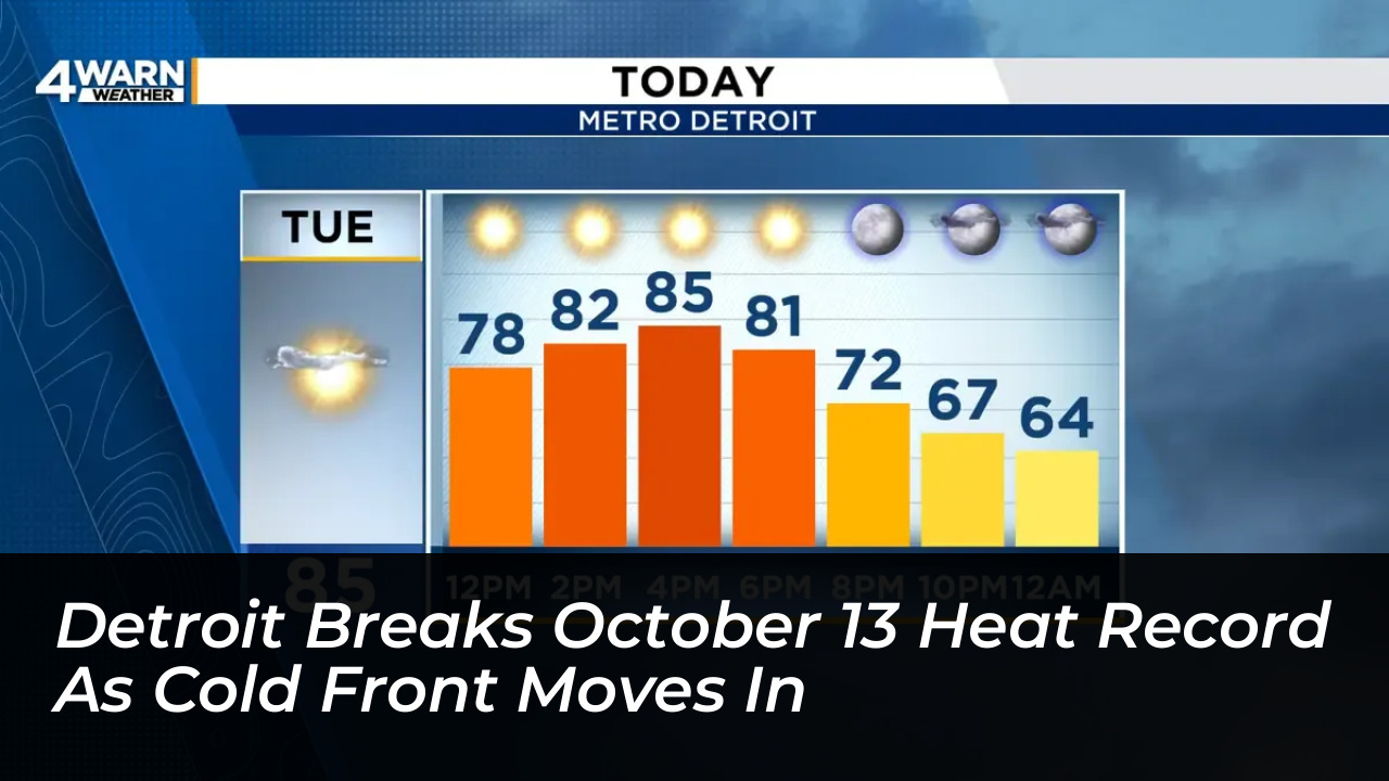

Unseasonably warm weather pushed Detroit past its October 13 temperature record on Tuesday, October 13, 2026, as readings climbed to 88 degrees at Coleman A Young Airport. The National Weather Service reported that the temperature exceeded the previous daily record of 83 degrees, set back in 1975, before an approaching cold front introduced rain chances and a sustained cooldown to Southeast Michigan.
Record-Breaking Warmth Driven by Southern Systems
The record-breaking warmth followed clear skies and southerly winds that allowed temperatures to surge into the upper 80s across the region. FOX 2 Detroit reported that the airport’s temperature gauges recorded a maximum of 88 degrees, surpassing the historical high by 5 degrees.
Meteorologist Alex Manion of the National Weather Service’s regional office in White Lake attributed the abnormally warm conditions partially to a high-pressure system across the southern United States interacting with a low-pressure system north of Detroit. “When we have a setup like this, you get southwestern winds bringing warm, summerlike air into southeast Michigan,” Manion explained.
WDIV’s 4Warn Weather forecast had projected afternoon highs in the low to mid-80s before the weather shift, but readings climbed faster than anticipated. Detroit had already reached at least 85 degrees by 2 p.m., easily clearing the historical threshold.
Widespread Highs Across Metro Detroit and Beyond
The intense heat was not confined to Detroit’s airport gauges. Multiple communities across Southeast Michigan recorded near-summer temperatures on Tuesday:
- Taylor: 89 degrees
- Harrison Township (Selfridge Air National Guard Base): 88 degrees
- Flint: 84 degrees (breaking its previous record of 83, also set in 1975)
- Warren, Macomb Township, Livonia, Rochester Hills, and Troy: 87 degrees
Monday’s relatively warm overnight lows of around 70 degrees, combined with completely clear skies on Tuesday, provided the ideal launching pad for the temperature spike.
A Dramatic Cooldown and Rain on the Horizon
The summerlike reprieve will be short-lived. A cold front settled over Michigan on Tuesday night, ushering in much cooler air and wet weather. Temperatures were expected to drop as low as 59 degrees overnight, with daytime highs on Wednesday capped in the upper 60s.
According to the National Weather Service, rain and potential thunderstorms are forecast for Wednesday, Thursday, and Friday. An even stronger cold front is projected to arrive on Friday, which could plunge temperatures down toward the mid-to-lower 30s by early Saturday morning.
While the sudden shift from record-setting heat to near-freezing conditions feels extreme, meteorologists note it is characteristic of mid-autumn transitions in the Midwest. “Records are records for a reason; they’re unusual,” Manion said. “But this combination of hot weather back to cool is pretty normal in October.”
Weekend forecasts currently show sunny skies returning, with daytime highs around 55 degrees on Saturday and 62 degrees on Sunday.