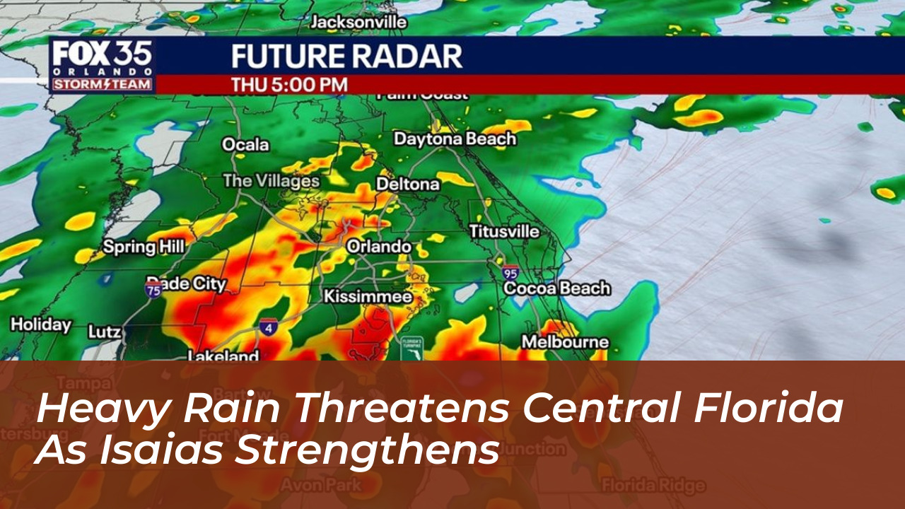


Central Florida faces another day of widespread rain and thunderstorms. A stalled front and deep tropical moisture from strengthening Hurricane Isaias fuel repeated downpours across the region. According to the FOX 35 Storm Team, rainfall totals could reach 2 to 4 inches in some areas on Thursday. This raises localized flooding concerns for communities that have already received several inches of rain over the past five days.
Rain chances are near 90% in parts of Central Florida. The heaviest storms may develop south of Orlando during the afternoon and evening hours. Temperatures should generally remain in the lower 80s, though some southern areas could reach the upper 80s where brief sunshine breaks through the cloud cover.
Hurricane Isaias Strengthens and Threatens Gulf Coast
While Central Florida deals with persistent downpours, Isaias strengthened into the first hurricane of the Atlantic season late Wednesday. It surged toward the U.S. Gulf Coast. The National Hurricane Center reported that the cyclone was centered about 460 miles south-southwest of the Mississippi River. It packed maximum sustained winds of roughly 75 mph. Forecasters warned that the storm is on track to make landfall between the Mississippi coast and the Florida Panhandle late Friday or early Saturday. It will bring heavy rains, damaging winds, and dangerous coastal flooding.
The hurricane formed more than four months into the Atlantic hurricane season. It nearly tied a 121-year-old record for the area’s latest-forming hurricane, which dates back to October 8, 1905. Officials noted that an unusually quiet season driven by a strong El Niño disrupted earlier storm development.
States of Emergency Declared in Florida and Alabama
Governors in Florida and Alabama quickly declared states of emergency for dozens of counties as the storm approached. Florida Gov. Ron DeSantis issued an executive order for 25 counties across the Panhandle and Big Bend regions. This order allowed state agencies to position resources ahead of potential impacts. The emergency order covers Baker, Bay, Calhoun, Columbia, Dixie, Escambia, Franklin, Gadsden, Gilchrist, Gulf, Hamilton, Holmes, Jackson, Jefferson, Lafayette, Leon, Liberty, Madison, Okaloosa, Santa Rosa, Suwannee, Taylor, Walton, Wakulla, and Washington counties.
Alabama Gov. Kay Ivey declared a state of emergency for 40 counties and urged residents to take preparations seriously. In Gulf Shores, Alabama, local officials encouraged voluntary evacuations for low-lying areas. They also canceled the upcoming National Shrimp Festival, which typically draws hundreds of thousands of visitors.
Energy Markets and Local Preparations
Ahead of the storm’s arrival, oil and gas producers in the Gulf of Mexico shut down a significant share of offshore production. They temporarily halted roughly 25% of regional oil output and took about 511,000 barrels a day off the market, according to the Marine Minerals Administration. Eight of the Gulf’s 371 manned oil platforms were evacuated.
Across North Florida and coastal Alabama, cities ramped up local preparations. Utilities pre-positioned repair crews. Municipal sites provided sandbags for residents looking to protect properties against rising water. Florida’s State Emergency Response Team staged generators, fuel, flood barriers, bottled water, meals, and tarps in Tallahassee and Santa Rosa for rapid deployment.
Central Florida Forecast and When It Clears
Direct impacts on Central Florida should remain limited to elevated rain chances rather than a direct landfall. Rain chances will dip slightly on Friday as the stalled front slowly lifts north, though a few afternoon and evening storms remain possible. Saturday will feature an increase in late-day showers and storms with widespread afternoon downpours.
Relief is in sight for next week. As the Gulf system moves away and high pressure strengthens, winds will turn northerly. This will push deep tropical moisture out of Florida by Monday and pave the way for much drier weather by the middle of next week.