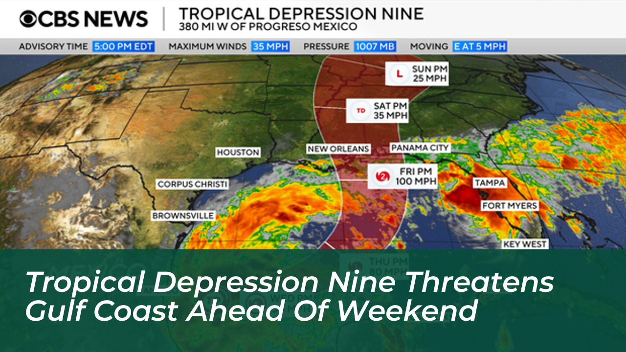


Tropical Depression Nine developed in the southern Gulf of Mexico on Tuesday, October 6, 2026. This system poses a new weather threat to the U.S. Gulf Coast as the Atlantic hurricane season nears its final weeks. The system is currently brewing over warm waters off Mexico in the Bay of Campeche. This has prompted meteorologists and emergency management officials to issue early alerts across the region.
Forecast models show growing agreement that the system will move northward and approach the Gulf Coast by this weekend. According to data from the National Hurricane Center, the system formed after a cluster of thunderstorms in the western Gulf attained a closed circulation. Officials note that it could soon become a tropical storm or potentially strengthen into a hurricane before making landfall.
Tracking the Path and Potential Intensity
The National Hurricane Center has scheduled low-level hurricane hunter flights to investigate the system’s structure and wind speeds. Early-stage forecasts carry typical uncertainties regarding speed and precise landfall coordinates. However, current computer models indicate a track spanning anywhere from Louisiana to the Florida Panhandle.
Experts emphasize that Gulf water temperatures well into the 80s provide ample energy for intensification over the coming days. The system must still contend with wind shear and dry air as it pushes northward. These factors could influence its final strength upon reaching the coastline.

Expected Impacts Across the Gulf Coast and Southeast
Regardless of whether the system intensifies into a major named storm, officials warn it will deliver moderate to heavy rainfall across the Gulf Coast and the wider Southeast from this weekend into early next week. Potential impacts include:
- Heavy rainfall totals ranging locally between 3 to 10 inches, which increases the risk of flash flooding.
- Storm surge flooding along vulnerable coastal zones near the landfall area.
- Strong, gusty winds capable of causing localized power outages.
- Isolated tornadoes near and to the east of the system’s center.
Residents living along the northern Gulf Coast-from Louisiana through the Florida Panhandle and the Big Bend-should monitor local weather forecasts closely. They must also review personal hurricane preparedness plans and remain alert for changing advisories as the weekend approaches.