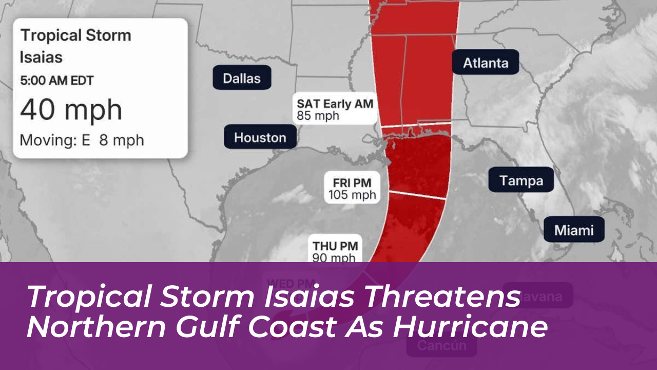


Tropical Storm Isaias has officially formed in the southwestern Gulf of Mexico off the eastern coast of Mexico. Meteorologists warn that the storm will rapidly intensify into a significant hurricane before striking the northern Gulf Coast. Carrying initial sustained winds of 40 mph, the system is projected to achieve full hurricane status, threatening coastal regions spanning from eastern Louisiana to the Florida Panhandle.
The National Hurricane Center upgraded the system to Tropical Storm Isaias early Wednesday, Oct. 7, 2026, as it spins in the southwestern Gulf. Forecasters anticipate the storm will reach hurricane strength by Thursday, October 8. It could then intensify to a high-end Category 2 strength by Friday evening, October 9, as it moves through the central Gulf waters.
Projected Path and Landfall Timeline
Computer models and National Hurricane Center tracks indicate that Isaias is expected to drift eastward before turning northward toward the Gulf Coast. While exact landfall coordinates carry standard early-forecast uncertainties, consensus models focus the highest risk zone between eastern Louisiana and the Florida Panhandle.
Tropical storm-force winds should reach portions of the Gulf Coast by Friday. The core of the system and its primary hazards will arrive late Friday or early Saturday. States including Mississippi, Alabama, and Florida are preparing for widespread environmental impacts.
Potential Hazards: Storm Surge, Flooding Rain, and Winds
Officials warn that the system’s threats extend far beyond its wind classification. Expected hazards include:
- Storm Surge: Inundation in low-lying coastal areas, coinciding with high king tides.
- Heavy Rainfall: Widespread accumulations of 3 to 6 inches, with localized totals reaching up to 10 inches or higher across parts of the Southeast and the Florida Panhandle. Flash flooding could extend well inland.
- Damaging Winds: Sustained winds and powerful gusts capable of downing trees and causing extended power outages.
- Isolated Tornadoes: Severe weather and tornado risks concentrated primarily to the east of the storm’s center.
Regional Preparedness and State Actions
In response to the mounting threat, Florida Governor Ron DeSantis declared a state of emergency for 25 counties across the western Panhandle and the Big Bend region. Emergency management officials are urging residents in vulnerable coastal and low-lying zones to review their hurricane evacuation plans, secure property, and monitor official forecasts closely.
Although the 2026 Atlantic hurricane season has experienced lower overall activity due to prevailing environmental factors, meteorologists emphasize that warm Gulf waters-with temperatures well into the 80s-provide ample energy for late-season intensification. Residents across the threatened coastline are advised to finalize emergency preparations ahead of anticipated hurricane and storm surge watches.