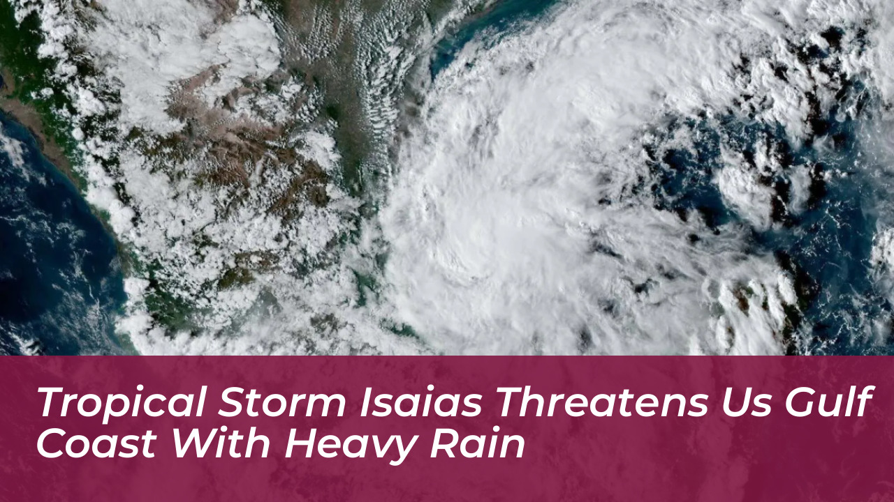


Tropical Depression Nine formed in the Gulf of Mexico on October 7, 2026, quickly organizing into Tropical Storm Isaias as the ninth named storm of the Atlantic hurricane season. The system is tracking northeastward and threatens the U.S. Gulf Coast with heavy rainfall, strong winds, and potential hurricane-strength impacts by the weekend.
Originating off Mexico’s Yucatán Peninsula and the Bay of Campeche, the system has prompted immediate concern from meteorologists at the National Hurricane Center. Forecasters project significant rainfall totals reaching six to 10 inches near the coast from southeast Louisiana to the Florida Panhandle. Additionally, two to four inches of rain could extend further inland across the Carolinas and the Southeast through the weekend.
Forecast Track and Potential Landfall
Computer model forecasts indicate that Isaias will drift before taking a more definitive northward pull toward the mainland. Current projections place potential landfall anywhere from eastern Louisiana to the Florida Panhandle by late Friday or early Saturday. AccuWeather analysts note that coastal areas in Mississippi and Alabama face elevated risks, with specific model trajectories pointing near Biloxi, Mississippi.
Authorities have stressed that the exact track remains subject to model variance. However, residents across the northern Gulf Coast are being urged to monitor local forecasts closely as watches and warnings are issued.
Intensity Factors and Environmental Hurdles
Sea surface temperatures across the Gulf of Mexico are running well into the 80s. This provides exceptionally warm water that acts as abundant fuel for the system to intensify. Despite these favorable thermal conditions, forecasters warn that strong wind shear near the northern Gulf Coast poses a major obstacle.
Wind shear-the change in wind speed and direction with height-is notoriously hostile to tropical development. As Isaias pushes further north, it will battle this environmental barrier, which could tilt or weaken the storm just before landfall. Even with these mitigating factors, current models suggest a measurable probability of the system reaching Category 1 hurricane strength with winds exceeding 75 mph before coming ashore.
Expected Hazards and Safety Precautions
The primary threats associated with Tropical Storm Isaias extend beyond wind intensity. Major hazards include:
- Heavy Rainfall and Flash Flooding: Widespread accumulations of three to six inches, with local maximums up to 10 inches or more, threaten urban and low-lying areas.
- Storm Surge: Coastal communities from Louisiana to Florida face rising waters and potential inundation along the immediate shoreline.
- Damaging Winds: Sustained winds and powerful gusts could lead to structural damage and power outages lasting several hours or multiple days.
- Isolated Tornadoes: The outer rain bands and severe weather environment create a favorable setup for brief, spin-up tornadoes across the Southeast.
Emergency management officials advise residents in the potential impact zone to finalize their hurricane preparedness plans, secure loose outdoor items, and avoid driving across flooded roadways.