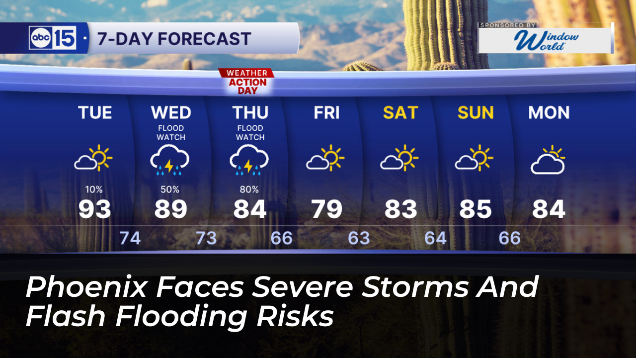

A powerful Pacific weather system is moving into Arizona. It brings a multi-day threat of heavy rain, flash flooding, and potentially destructive thunderstorms to Phoenix and surrounding communities. This threat lasts from Wednesday, October 21, through Thursday, October 22. Forecasters have issued active flood watches across central and eastern regions. They warn residents that intense downpours and high winds could severely disrupt travel and pose safety risks.
According to the National Weather Service (NWS) in Phoenix and local reports from azcentral.com, the most severe impacts in the Phoenix metropolitan area are anticipated from Wednesday evening into Thursday morning. Repeated thunderstorm activity during this window is expected to drop rapid rainfall accumulations across Maricopa and Pinal counties.
Rainfall Totals and Regional Impacts
Rainfall projections vary widely depending on elevation and location across south-central Arizona:
- Metro Phoenix: Expected to receive between 0.25 and 1.25 inches of rain, with higher totals concentrated in eastern and northeastern parts of the Valley.
- Foothills and Higher Terrain: Areas near northeast Maricopa County and the Mogollon Rim could record between 1.50 and 3 inches of rainfall.
- Rainfall Rates: Forecasters warn that intense individual storms could produce rainfall rates reaching 1 to 2 inches per hour. This significantly elevates flash flood risks in low-lying areas and urban washes.
Severe Weather Threats: Winds, Hail, and Tornadoes
Gabriel Lojero, a meteorologist with the NWS in Phoenix, noted that an increase in atmospheric instability will drive multiple rounds of showers and thunderstorms. Beyond heavy water accumulation, the storm system carries threats of damaging winds exceeding 60 mph. It also brings large hail up to 2 inches in diameter and even isolated tornadoes, particularly across higher terrain areas on Wednesday.
The sudden influx of storm activity is expected to sharply drop regional temperatures. High temperatures in the Phoenix area typically hover near 90 degrees early in the week. By Thursday and Friday, these highs are projected to struggle to reach 80 degrees. This places daytime highs roughly 10 degrees below normal for late October.
Safety Guidelines and Precautions
Local emergency management officials and the American Red Cross urge residents to take proactive safety measures throughout the active weather days:
- Turn Around, Don’t Drown: Never drive across flooded roadways or around barricades. It takes very little moving water to sweep a vehicle away.
- Secure Outdoor Property: High winds can toss unsecured objects, patio furniture, and debris. Bring pets and loose items indoors.
- Prepare for Outages: Keep flashlights, extra batteries, and a battery-powered or hand-crank radio accessible in case of localized power interruptions.
- Stay Informed: Monitor local forecasts and emergency alerts closely as conditions change through Thursday evening.
Weather conditions are expected to improve gradually by Friday, making way for drier air, rising humidity levels, and clearing skies heading into the weekend.