

Florida Governor Ron DeSantis declared a state of emergency for 25 counties on Tuesday, October 6, 2026, as Tropical Storm Isaias rapidly strengthened in the southwestern Gulf of Mexico. The developing system poses a severe weather threat to the Gulf Coast and North Georgia, with impacts expected to stretch through the weekend.
The system originated as Tropical Depression Nine before quickly organizing into Tropical Storm Isaias. Packing sustained winds of 40 mph while moving east-northeast at 8 mph, forecasters project the storm will intensify into a hurricane by Thursday, October 8, 2026. Experts warn it could reach strong Category 2 intensity-with winds between 85 and 110 mph-before making landfall along the northern Gulf Coast late Friday or early Saturday.
Emergency Declaration and Pre-Positioned Resources
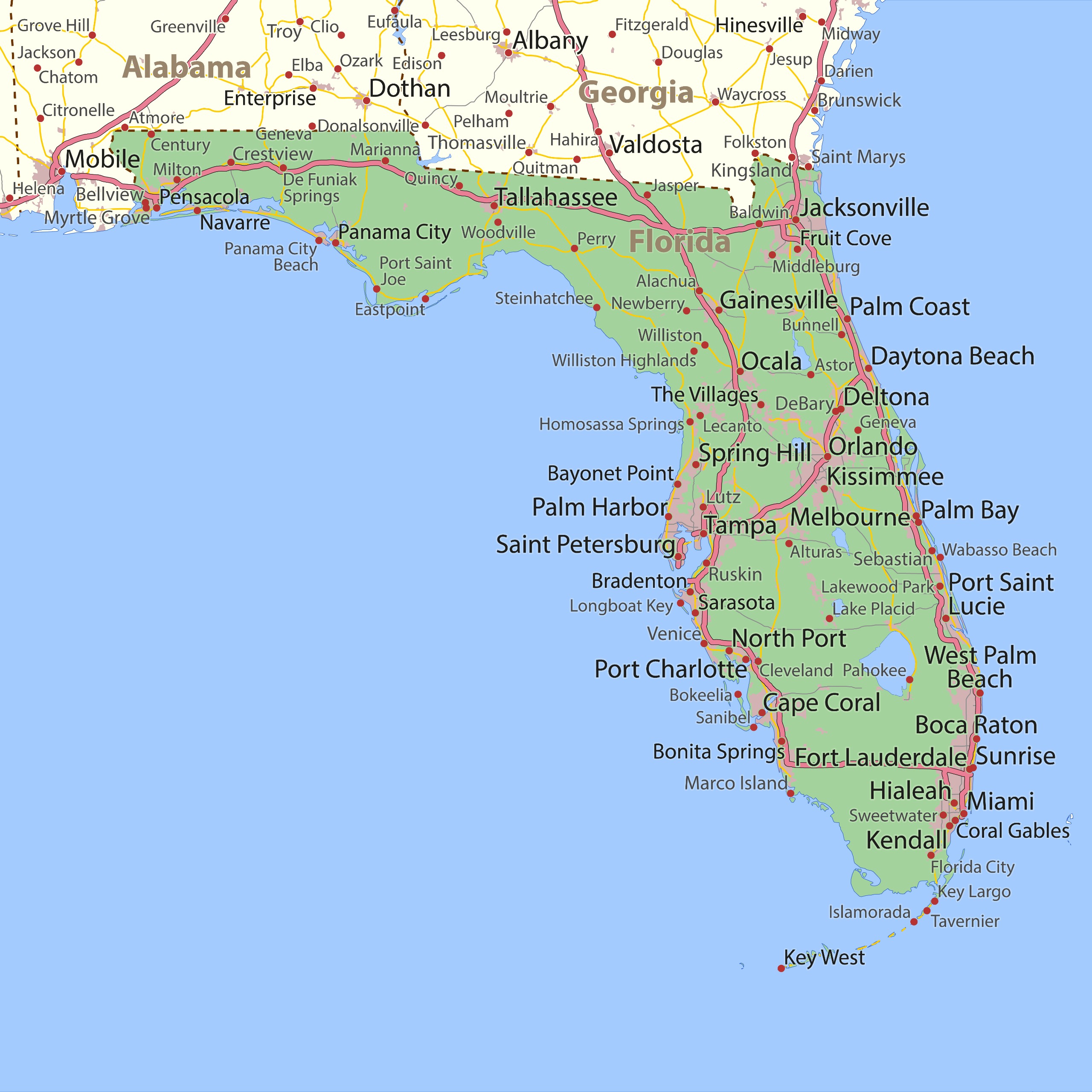
In response to the escalating threat, Governor DeSantis signed Executive Order 26-202, activating state emergency management protocols across 25 northern counties. The declaration covers a broad region from Escambia and Santa Rosa to Baker and Leon counties, encompassing the Panhandle and Big Bend areas.
The emergency order gives state agencies the flexibility to mobilize resources immediately. The Florida Division of Emergency Management has begun pre-positioning critical supplies, including:
- Emergency generators and portable fuel reserves
- Flood barriers, sandbags, and heavy-duty tarps
- Bottled water and shelf-stable food rations
- Staging operations centered around Tallahassee and Santa Rosa County
“This order ensures communities have the time and resources necessary to prepare for potential severe weather impacts to the Panhandle and Big Bend,” Governor DeSantis said in a public statement. Officials strongly encourage residents within the projected impact zone to finalize their personal disaster plans and stock up on essential hurricane supplies.
Projected Path and Expected Impacts
According to the National Hurricane Center (NHC) and computer forecast models, Isaias is expected to drift east, pass north of the Yucatan Peninsula, and make a sharp northward turn toward the U.S. coastline. The primary landfall zone currently spans between eastern Louisiana and the Florida Panhandle, placing areas from Biloxi, Mississippi, to Panama City, Florida, directly in the path of the storm.
Meteorologists point to record-warm Gulf waters-sitting at their highest levels since 1982-as a primary fuel source for rapid intensification. However, hostile wind shear could influence the system’s ultimate structure prior to landfall.
Widespread Weather Hazards Beyond the Coast
While coastal regions face destructive winds and potential storm surge, emergency managers warn that heavy rainfall will create widespread hazards far inland. Forecast models indicate:
- Torrential Rainfall: Widespread accumulations of 3 to 6 inches are expected across the northern Gulf Coast, with isolated totals reaching up to 10 inches.
- Flash Flooding: NOAA’s Weather Prediction Center has issued elevated flash flood risks for parts of the Southeast, Appalachians, and the Ohio Valley.
- Saturated Soils: Because regional soils are already saturated from recent weather, heavy rain will quickly trigger localized flooding.
- Severe Thunderstorms: AccuWeather meteorologists note an increased risk of severe weather, including tornadoes and waterspouts, primarily east of the storm’s center.
As Isaias tracks inland through the weekend, residents across the Southeast and surrounding regions are advised to monitor local alerts and prepare for prolonged weather disruptions.
Frequently Asked Questions
When did Tropical Storm Isaias form?
Tropical Depression Nine strengthened into Tropical Storm Isaias in the southwestern Gulf of Mexico on Tuesday, October 6, 2026. The National Hurricane Center issued its first advisory early Wednesday morning.
Which counties are included in Florida’s state of emergency?
Governor Ron DeSantis declared a state of emergency for 25 northern counties, stretching from Escambia and Santa Rosa in the western Panhandle to Baker and Leon counties.
How strong is Isaias expected to become?
Forecasters expect Isaias to rapidly intensify into a hurricane by Thursday, October 8, 2026. It could potentially reach Category 2 status with sustained winds approaching 110 mph before making landfall.
What are the primary hazards associated with the storm?
The main threats include hurricane-force winds, dangerous coastal storm surge near the landfall zone, 3 to 6 inches of heavy rainfall leading to flash flooding, and a risk of tornadoes across the Southeast.
Where is Isaias projected to make landfall?
Current forecast tracks place the likely landfall window on late Friday or early Saturday, targeting an area between eastern Louisiana and the Florida Panhandle.