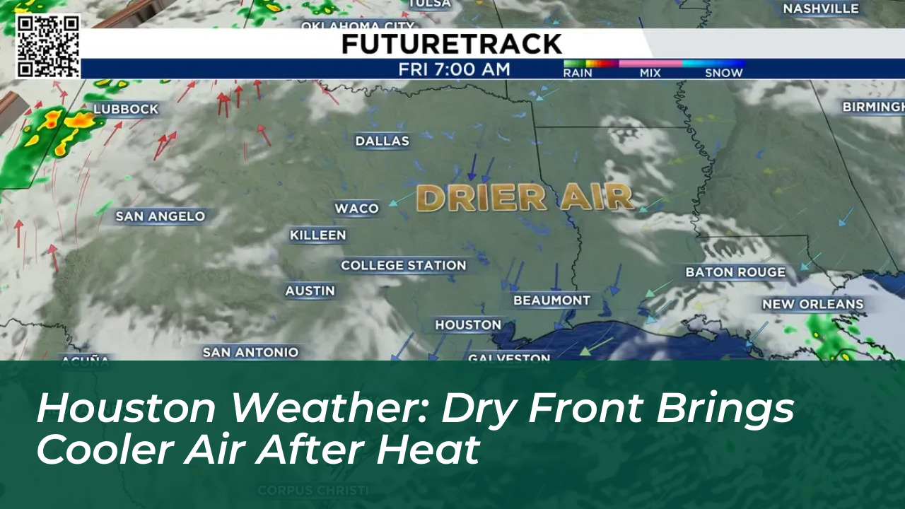
A fresh dry front brings cooler air to Houston after record heat, offering much-needed relief from a relentless late-summer heatwave. Residents across Southeast Texas have endured weeks of oppressive temperatures and thick humidity, but a notable shift in the jet stream is finally clearing out the stagnant Gulf air mass. This comprehensive weather transition brings plunging dewpoints, crisp morning lows, and ideal outdoor conditions for the weekend before atmospheric moisture returns early next week.
- Understanding the September Heat Spike in Houston
- Record-Breaking Temperatures at Bush Intercontinental
- The Role of Tropical Humidity and High Dewpoints
- The Mechanics of the Incoming Dry Front
- Continental Air Mass Transport
- The Physics Behind Lower Dewpoints
- What to Expect on Thursday Afternoon
- Temperature Climbs Before the Wind Shift
- Evening Wind Speed Increases and Humidity Drops
- Friday Morning Temperature Drops and Outdoor Comfort
- Temperatures in Houston Proper
- Crisp Conditions North of Interstate 10
- Weekend Weather Outlook and Secondary Environmental Concerns
- Ideal Outdoor Conditions Through Saturday
- Wildfire Risk and Soil Dryness Considerations
- Air Quality, Ozone Levels, and Allergen Impacts
- Post-Frontal Ozone Pollution Watches
- Active Ragweed Pollen and Mold Spores
- Looking Ahead to Next Week and Tropical Activity
- Pacific Moisture Influx and Mid-Week Rain Chances
- Surveillance of Tropical Systems
- Frequently Asked Questions
- How long will the cool weather last in Houston?
- Will the dry front bring any rain to Southeast Texas?
- When is the best time for outdoor activities this weekend?
- How can residents stay updated on changing forecasts?
Understanding the September Heat Spike in Houston
Contextualizing the recent intense heatwave requires examining recording methodologies at Bush Intercontinental Airport and the heavy impact of tropical humidity on Southeast Texas. Houston recently endured a relentless stretch of late-summer heat, pushing meteorologists and residents alike to the limit. Persistent upper-90s temperatures combined with thick tropical humidity to create oppressive atmospheric conditions across Harris County and surrounding areas. This stagnant weather pattern kept air conditioning units working overtime day and night.
Such extreme late-September heat is not entirely unprecedented, but the intensity and lack of early-fall relief caught many local communities off guard. High dewpoints in the mid-70s made the air feel heavy and saturated, exacerbating physical discomfort during outdoor activities. Fortunately, atmospheric dynamics high above the continent are finally shifting to alter this relentless weather regime and welcome a refreshing change.

Record-Breaking Temperatures at Bush Intercontinental
Analysis of the 99-degree reading reveals a close proximity to historical September records established over the past three decades.
The Role of Tropical Humidity and High Dewpoints
Mid-70s dewpoints created oppressive atmospheric conditions across Harris County during the peak of the late-summer heatwave.
The Mechanics of the Incoming Dry Front
Meteorological relief arrives as a dry, cool air mass pushes down from the north, sweeping away the heavy Gulf humidity. This transition relies on a distinct change in wind direction across the region. Northeasterly winds transport continental dry air into Southeast Texas, replacing the marine tropical air mass that dominated the middle of the week. As this boundary clears the area, dewpoints plunge from the muggy mid-70s down into the comfortable lower 60s and upper 50s.
This dramatic drop in moisture content alters how the human body perceives temperature. Lower dewpoints allow perspiration to evaporate efficiently, providing immediate outdoor comfort even as afternoon thermometer readings hover in the lower 90s. The physics behind this boundary layer movement explain why autumn-like air masses feel so dramatically different from summer regimes, even when air temperatures remain relatively warm during peak daylight hours.
Continental Air Mass Transport
The sudden shift from southerly marine flow to northeasterly continental transport facilitates rapid cooling.
The Physics Behind Lower Dewpoints
Plummeting dewpoints from the mid-70s down into the upper 50s and lower 60s transform outdoor environmental conditions.
What to Expect on Thursday Afternoon
Thursday serves as the transitional battleground between the departing summer heat and the incoming cooler front. Temperatures make another quick climb into the low-to-mid 90s during the afternoon hours before the wind shift takes full effect. Isolated showers and sea-breeze thunderstorms may spark briefly south of Interstate 10, but widespread rainfall is not expected with this initial dry boundary.
As late afternoon turns into evening, the northeasterly breeze picks up speed across the metropolitan area. Residents notice a rapid decrease in humidity levels by nightfall, setting the stage for the first genuinely pleasant morning atmosphere in months. This rapid environmental flip showcases the abrupt nature of strong frontal passages during early autumn transitions.
Temperature Climbs Before the Wind Shift
Afternoon thermometer readings reach the low-to-mid 90s before the northern winds officially arrive across Harris County.
Evening Wind Speed Increases and Humidity Drops
Rapid environmental changes occur during the late afternoon hours as dry air displaces lingering moisture.
Friday Morning Temperature Drops and Outdoor Comfort
Friday morning delivers the most rewarding aspect of this weather shift for residents across the region. Areas north of Interstate 10 wake up to crisp temperatures dropping into the upper 50s and low 60s. Closer to the city center and along the immediate coastal plain, official thermometers bottom out near the 70-degree mark.
For Houston proper, this represents the coolest morning reading since late May, offering a true preview of autumn conditions. Clear skies and abundant sunshine define the daylight hours, making Friday ideal for high school football games, evening jogs, and outdoor recreational events.
Temperatures in Houston Proper
Official temperatures bottom out near 70 degrees right in the city center during the early morning hours.
Crisp Conditions North of Interstate 10
Morning lows plunge into the upper 50s and low 60s across northern suburbs and outlying rural counties.
Weekend Weather Outlook and Secondary Environmental Concerns
The pleasant atmospheric conditions hold steady through Saturday, maintaining dry air and comfortable morning lows across the region. Football fans heading out to Friday night games or Saturday morning runners experience ideal weather conditions rarely felt during September in Southeast Texas. However, this dry air package brings secondary environmental concerns that require local vigilance.
Extended periods of low humidity combined with ongoing rainfall deficits increase soil dryness. Local authorities advise caution regarding open flames, as elevated fire danger and worsening drought conditions frequently accompany dry continental air masses moving into the coastal plain.
Ideal Outdoor Conditions Through Saturday
Comfortable humidity levels support Friday night football games and early weekend runners across the metropolitan footprint.
Wildfire Risk and Soil Dryness Considerations
Elevated fire danger results from extended periods of low humidity and prolonged seasonal dry spells.
Air Quality, Ozone Levels, and Allergen Impacts
Clear skies and shifting winds also influence local air quality metrics across the urban landscape. Afternoon ozone pollution watches frequently accompany stagnant, sunny post-frontal environments. Ozone acts as a lung irritant capable of triggering respiratory distress for sensitive groups, including children and individuals with asthma.
Additionally, high concentrations of ragweed pollen and mold spores remain active in the regional atmosphere. Allergy sufferers should anticipate potential sneezing and sniffling as outdoor activities resume under the sunny weekend sky, making antihistamines a necessary accessory for outdoor enthusiasts.
Post-Frontal Ozone Pollution Watches
Stagnant, sunny environments contribute to elevated surface ozone levels during peak afternoon heating cycles.
Active Ragweed Pollen and Mold Spores
High concentrations of airborne allergens appear in regional air samples collected by local health departments.
Looking Ahead to Next Week and Tropical Activity
The respite from humidity remains brief as moisture returns by Sunday, setting the stage for a more unsettled weather pattern early next week. Forecasters monitor complex interactions between regional frontal boundaries and tropical moisture originating from the Pacific Ocean. Remnant moisture from Pacific hurricane activity could combine with a slow-moving cold front dropping down from the Plains.
This setup introduces a 40 percent chance of rain by Wednesday and Thursday, potentially bringing much-needed precipitation to combat local drought conditions. Meanwhile, tropical monitoring remains active across both ocean basins as the peak of hurricane season continues, though current modeling indicates no immediate threat to the United States mainland.
Pacific Moisture Influx and Mid-Week Rain Chances
Remnant moisture interacts with cold fronts dropping southward from the North American Plains.
Surveillance of Tropical Systems
Tracking systems like Pacific tropical storms ensures accurate upper-level moisture transport forecasting.
Frequently Asked Questions
How long will the cool weather last in Houston?
The exceptionally comfortable dry air and lower temperatures will persist through Saturday before humidity begins returning on Sunday.
Will the dry front bring any rain to Southeast Texas?
No significant rainfall is expected with this initial dry boundary, as moisture levels remain too low to support shower development.
When is the best time for outdoor activities this weekend?
Friday evening and Saturday morning offer the most ideal outdoor conditions with clear skies, sunshine, and low humidity.
How can residents stay updated on changing forecasts?
Local municipal weather alerts and meteorological radar tracking tools provide real-time updates on atmospheric shifts.