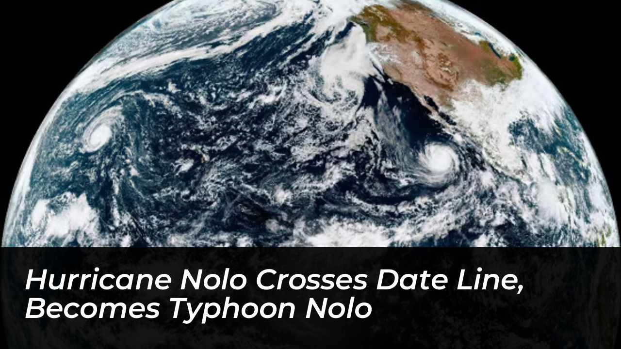



A powerful tropical cyclone tracking across the Pacific Ocean transitioned from Hurricane Nolo to Typhoon Nolo. This change occurred after the storm crossed the International Date Line into the western North Pacific Basin on Sunday.
As of Monday morning Japan time, the storm maintained sustained winds of 100 mph. It was moving west at 19 mph, according to the Japan Meteorological Agency. Central Pacific Hurricane Center and National Hurricane Center advisories noted that Nolo retained its physical structure and official name despite crossing the 180° longitude boundary. Meteorologists confirmed the storm remains over open waters and currently poses no immediate threat to landmasses.
Why Did Hurricane Nolo Become a Typhoon?
The transformation of Nolo from a hurricane into a typhoon is a matter of geography. It is not a change in the storm’s intensity or physical structure. Tropical cyclones swirling in the central and eastern Pacific Ocean are classified as hurricanes. Identical storms in the western North Pacific Ocean are designated as typhoons.
The 180° longitude meridian roughly aligns with the International Date Line. It marks the official boundary between these two meteorological monitoring regions. When the center of Nolo crossed this line, tracking responsibility shifted from North American monitoring centers to forecasters covering the western North Pacific. This shift prompted the administrative name change.
The Long and Unusual Journey of Nolo
Nolo’s path across the Pacific has featured remarkable shifts in strength and longevity. The storm originally formed as a tropical depression on September 13 off the coast of Mexico before dissipating two days later. However, it later regenerated into a “zombie storm,” officially earning the name Tropical Storm Nolo on September 23.
As it tracked westward, Nolo passed south of Hawaii. It triggered severe flooding from rainfall totals reaching up to 17.25 inches and knocked out power across parts of the island state. Emergency crews, including members of the Hawaii Army National Guard, deployed to manage flooded infrastructure. This included sections of the Mamalahoa highway near Naalehu.

Following its passage near Hawaii, Nolo rapidly intensified. It reached Category 4 status on the Saffir-Simpson Wind Scale on September 28.
Current Status and Future Forecast
By the time it crossed the International Date Line, Nolo had weakened slightly into a Category 3 equivalent storm. Forecasters expect the system to continue losing wind intensity as it tracks further west through the week.
“The storm will gradually lose wind intensity as it tracks westward through Thursday,” said AccuWeather Meteorologist Jason Nicholls.
Meteorologists anticipate a north-then-northeast turn late in the week and into the weekend. Because of this expected trajectory, Nolo is projected to pass well east of Japan. It will remain clear of major landmasses, posing no significant danger to populated coastal regions.