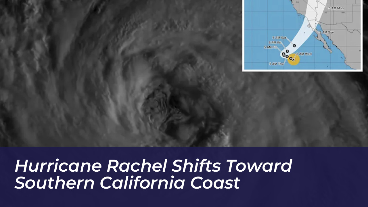


A major Pacific storm, Hurricane Rachel, is advancing toward the West Coast. It threatens the Southern California region with potential coastal hazards, heavy moisture, and shifting weather patterns. According to the National Weather Service, forecasters are closely monitoring the storm’s unpredictable track, uncertain timing, and expected weakening trend as it encounters cooler ocean water and dry air.
Current meteorological models place the storm coming ashore approximately 100 miles south of San Diego. However, the National Weather Service cautions that the tracking path could shift northward toward Orange County. This prompts warnings for residents across Southern California and surrounding desert communities to remain vigilant and monitor continuous weather updates.
Forecast Track and Meteorological Factors
An incoming weather system moving from the northwest is expected to alter Hurricane Rachel’s trajectory. This interaction will likely cause the storm to slow down significantly before making a sharp turn and accelerating toward Baja California and Southern California.
While the hurricane itself is forecast to disintegrate into a post-tropical storm, its leftover moisture will be absorbed into a separate low-pressure system forming off the coast. This combined system is projected to move northeastward, bringing rain to the northern coast of Baja California Sur and Southern California over the weekend.
Climate experts note that these dynamic weather changes arrive amidst a brutal heat wave. Several regional weather stations recently shattered maximum high-temperature records:
- Escondido: Reached 105 degrees, breaking previous records set in 1953 and 1893.
- Vista: Reached 101 degrees, surpassing records from 1971 and 1957.
- Ramona: Reached 101 degrees, breaking the prior record set in recent years.
- Anaheim: Reached 100 degrees, edging out previous highs from 2005 and 1989.
Broader Pacific Storm Activity and El Niño Influence
The eastern Pacific remains exceptionally active under the influence of a strengthening El Niño cycle. Alongside Hurricane Rachel, additional tropical systems continue to develop. The National Hurricane Center recently tracked Tropical Depression Twenty-E, which formed in early October as the 22nd storm of the season in the eastern and central Pacific.
Sea surface temperatures far to the south of California continue to shatter historical climate records. Daily ocean temperatures in the El Niño 3.4 region recently hit an unprecedented 86 degrees Fahrenheit (30 degrees Celsius), fueled by record-warm water anomalies that exceed previous benchmarks set during past strong El Niño years.
Expected Regional Impacts
For residents in Southern California, the remnants of Hurricane Rachel bring mixed conditions. On the positive side, the storm system is expected to offer temporary relief from relentless high temperatures. Rain associated with the system is forecast to move inland, reaching Arizona and Nevada over the weekend before stretching into Utah.
At the same time, climate scientists warn that a strong low-pressure setup could generate powerful onshore winds, increasing the risk of significant coastal flooding along vulnerable beach communities. Authorities advise local residents to secure outdoor items, stay clear of hazardous coastal areas, and keep emergency kits updated as the storm system approaches.