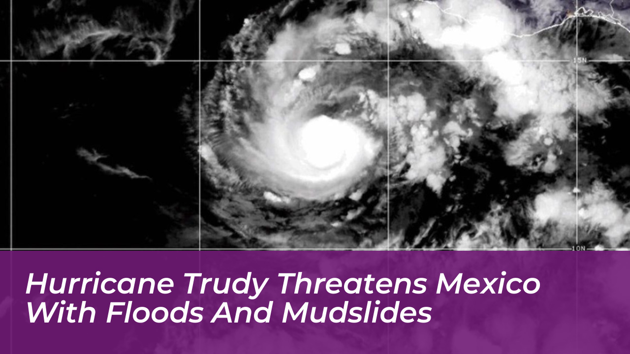

Hurricane Trudy churned off Mexico’s Pacific coast on Sunday, Oct. 18, 2026, delivering torrential downpours and strong winds to western and southwestern states already battered by recent tropical systems. The U.S. National Hurricane Center (NHC) issued urgent warnings for residents across Michoacán, Colima, and Jalisco. The agency highlighted the threat of potentially life-threatening flash floods and mudslides as the Category 2 storm tracked northwest parallel to the coastline.
Storm Track, Intensity, and Current Status
According to the NHC’s early Sunday updates, Hurricane Trudy maintained maximum sustained winds of 105 mph (165 kph). The center of the storm was located approximately 135 miles west-southwest of Manzanillo. It moved northwest at a steady speed of 10 mph (17 kph). The system had previously intensified into a major Category 3 hurricane late last week with winds reaching 120 mph (195 kph), but it subsequently weakened to a Category 2 status.
Forecasters projected that Trudy’s center would track close to the Mexican coastline through Sunday evening before eventually turning south of the Baja California Peninsula. Active weather alerts included a hurricane warning stretching from Manzanillo in Colima state to Cabo Corrientes in Jalisco. Additionally, a tropical storm warning remained in effect for Las Islas Marias. An earlier warning covering the coast from Punta San Telmo to Lazaro Cardenas was officially discontinued.
Severe Rainfall and Saturated Ground Elevate Risks
Meteorologists emphasized that wind speeds represented only part of the hazard. Trudy was forecast to dump 4 to 8 inches of rain across the region through the weekend. Isolated maximum totals were expected to hit roughly 12 inches (up to 30 centimeters) along coastal and mountainous zones in Michoacán, Colima, and Jalisco.
Civil protection authorities and local emergency management agencies stressed that consecutive storms earlier in the season-including Hurricane Simon-had left regional soils heavily saturated. Because of this pre-existing ground moisture, steep mountain terrains and narrow river valleys face heightened vulnerabilities. In these areas, even moderate downpours can rapidly transform into destructive debris flows and landslides.
"Trudy’s center was expected to remain near the Mexican coast through Sunday evening before moving south of the Baja California Peninsula," noted forecasters at the National Hurricane Center.
Government and Naval Precautions Across Affected States
Mexican naval authorities urged all mariners, commercial vessels, and coastal communities to exercise extreme caution in response to dangerous high waves, heavy squalls, and surging river levels. Local officials in Colima noted that while baseline infrastructure risks remained under initial monitoring, the accumulation of sustained rainfall posed significant threats to rural communities and vulnerable roadways.
Ahead of the storm’s closest approach, regional municipalities mobilized emergency response teams. Authorities in Guerrero suspended public classes across numerous municipalities late last week. Commercial storefronts in tourist corridors like Puerto Vallarta boarded up windows, and local fishermen secured small craft along waterfronts in Acapulco.
A Relentless Eastern Pacific Season
Trudy represents another major disruption in an exceptionally active Eastern Pacific hurricane season. Driven by elevated sea surface temperatures linked to a robust El Niño cycle, the 2026 season has surpassed historical benchmarks for accumulated cyclone energy. This left local emergency infrastructure with minimal recovery windows between successive weather events.
As emergency crews maintain high alert levels across Jalisco, Colima, and Michoacán, federal and state agencies continue to monitor radar updates. Officials remind residents that tropical systems frequently present severe flash-flooding hazards long after their peak wind categories begin to subside.