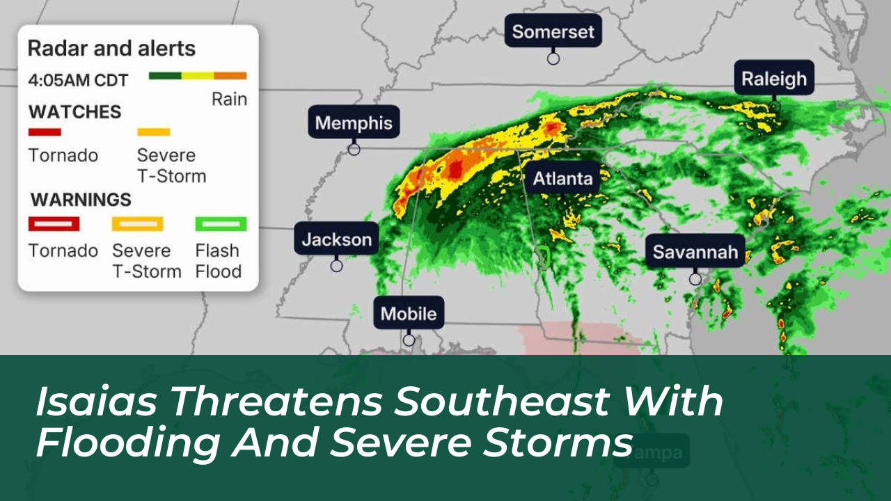

Heavy rainfall, damaging winds, and a potential tornado threat are impacting communities across the southeastern United States as Isaias moves inland toward the southern Appalachians and the mid-Atlantic. The post-tropical system continues to carry substantial moisture inland, maintaining a significant flash-flood threat extending into the Ohio Valley and Northeast through the weekend.

Rainfall Totals and Flood Risks Across the Southeast
The heaviest rainfall is concentrated across Georgia, Alabama, and Tennessee. Weather reports show rainfall totals could reach up to 15 inches in localized areas near the Gulf Coast, particularly east of the storm’s center where successive bands of heavy rain persist. Other Gulf Coast communities are receiving 4 to 8 inches, while much of the remaining Southeast faces forecasts of 2 to 5 inches, with isolated amounts up to 10 inches in the foothills of the southern Appalachians and coastal Carolinas.
The National Weather Service and meteorologists emphasize that although Isaias has lost its tropical characteristics, the system’s substantial moisture feed remains dangerous. Flash flood warnings and active watches cover multiple states as the slow-moving moisture tracks northward.
Wind Damage and Tornado Threats
Wind gusts capable of producing tree damage and power outages extend far inland across eastern Mississippi, Alabama, Georgia, and the Smoky Mountains, with gusts reaching up to 60 mph or higher in localized areas. Ground soaked by heavy rain allows trees to topple more easily, raising the risk of prolonged power outages.
Additionally, a threat for tornadoes exists across Georgia, the eastern Florida Panhandle, and South Carolina. Favorable atmospheric wind shear conditions have created an environment capable of supporting rotating supercell thunderstorms within the storm’s outer rainbands.
Weekend Track and Regional Impacts
On Saturday, Isaias continues moving inland while weakening, spreading heavy rainfall and powerful winds across cities including Memphis, Nashville, Atlanta, Wilmington, Charleston, Tallahassee, and Orlando. By Sunday, the remnants of the system will track further north:
- Heavy rainfall will affect parts of the Great Lakes, mid-Atlantic, and Northeast.
- Precipitation will impact Savannah, Nashville, Charlotte, Virginia Beach, Washington, D.C., New York City, Philadelphia, and Baltimore.
- Outer rain bands could even bring showers as far north as Cincinnati and Detroit.
Safety and Emergency Preparedness
Emergency management officials advise residents in affected zones to remain alert, avoid flood-prone areas, and never drive across flooded roadways. Power outages could last anywhere from several hours to multiple days, particularly in areas closer to the initial coastal impact zone where hurricane and tropical storm warnings were previously in effect.