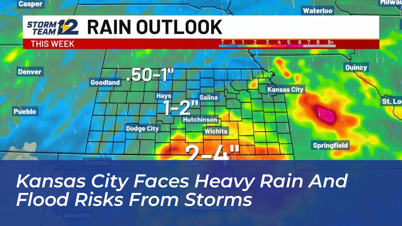

Heavy rain and severe thunderstorms are moving across the Kansas City area. A cold front is sweeping through the region, bringing risks of localized flooding, damaging winds, and hail. Local forecasters and the National Weather Service are monitoring the weather system, which is expected to impact the area through Wednesday and Thursday.
Reports from KMBC and the National Weather Service show that a Severe Thunderstorm Watch and a Flood Watch were issued for a large portion of the Kansas City metropolitan area. The active weather system began impacting the region around 6 p.m. and will continue through the overnight hours.
Flood Watch Details and Impacted Areas
The National Weather Service expanded Flood Watches to cover several counties across eastern Kansas and western Missouri. The alert includes Leavenworth, Wyandotte, and Johnson counties in Kansas, alongside Platte, Clay, and Jackson counties in Missouri.
Major communities within the watch zone include:
- Kansas City, Missouri
- Kansas City, Kansas
- Overland Park
- Olathe
- Lenexa and Shawnee
- Independence and Liberty
- Parkville, Platte City, and Leavenworth
A Flood Watch serves as a preparedness alert. It indicates that flooding is possible if heavy rain develops, though it does not guarantee that every neighborhood will flood. Forecasters note that the primary concern is repetitive downpours dropping heavy rain over the same low-lying areas, creeks, and roadways during the evening and night.
Rainfall Totals and Severe Weather Hazards
Forecast models indicate that overnight rainfall totals will range between 1 and 3 inches across the region. Heavier localized bands may exceed those amounts. In addition to heavy precipitation and the rising threat of flash floods, the strongest storms carry the potential for:
- Damaging wind gusts capable of downing tree limbs and power lines
- Large hail
- Brief reductions in visibility that may impact driving and local aviation conditions
Forecasters emphasize that the tornado threat remains extremely low, though it is not entirely zero as the system pushes through. Residents living in flood-prone neighborhoods or near overflowing creeks should stay updated on local forecasts, as watches can quickly upgrade to urgent Flood Warnings if conditions deteriorate rapidly.