Widespread torrential rain and severe thunderstorms struck eastern Nebraska and western Iowa on Wednesday night. The storms prompted urgent flash flood warnings across Lancaster County and forced local officials to temporarily barricade inundated roads.
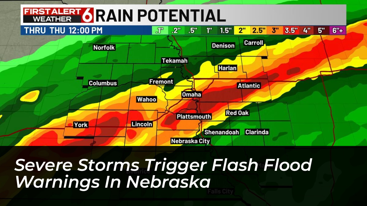
Meteorologists warned that a concentrated weather band could drop 3 to 5 inches of rainfall across parts of the Omaha metropolitan area, Lincoln, and Hebron through Thursday morning. Due to existing soil saturation and rising streams, the risk of rapid localized flooding remains significantly elevated throughout the region.

Urban Intersections Inundated by Heavy Rainfall
Initial downpours quickly overwhelmed drainage systems, inundating multiple urban intersections late Wednesday evening. Among the hardest hit areas was the intersection of 48th Street and Cornhusker Highway in Lincoln.
Municipal workers erected temporary barricades around 8:50 p.m. to prevent motorists from attempting to navigate the dangerous, rising waters. Officials successfully reopened the major corridor about an hour later once waters receded slightly.
National Weather Service Guidance and Safety Precautions
The National Weather Service continues to monitor live radar data as slow-moving storm cells progress eastward. Emergency management agencies across Lancaster County urge residents to practice extreme caution during nighttime driving conditions.
- Never drive across flooded roadways or around temporary barricades.
- Stay tuned to local weather radio or NOAA broadcasts for real-time radar updates.
- Move to higher ground immediately if flash flooding threatens your immediate neighborhood.
Broader Impact Across Eastern Nebraska and Western Iowa
Emergency response teams remain on standby as the severe weather system tracks across neighboring counties. Public safety officials stress that saturated grounds mean any additional rainfall will instantly run off into local creeks, rivers, and low-lying urban sectors, increasing the potential for property damage and hazardous travel conditions well into the morning hours.