
Washington, D.C. recorded a high of 90 degrees on Wednesday, breaking a long-standing October temperature record before an approaching cold front brings showers, strong winds, and a sharp cooldown. This unusual mid-autumn warmth also set a new record for the latest 90-degree day of the year in the District’s official temperature history, which dates back to 1872.
Wednesday’s high surpassed the previous daily record of 87 degrees, set in 1975. More notably, the reading broke the all-time record for the latest 90-degree temperature in a calendar year, a milestone previously established on October 11, 1919.
Weather Whiplash and Imminent Cooldown
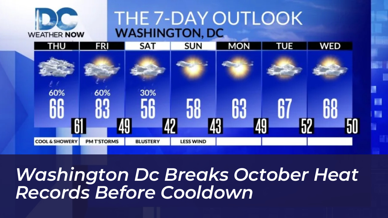
These summer-like conditions will be short-lived as a cold front moves through the mid-Atlantic. Temperatures are expected to fall into the 60s on Thursday, accompanied by increased cloud cover, scattered showers, and patchy fog that could impact the morning commute.
Thursday will feel roughly 30 degrees cooler than Wednesday’s peak. This brings an abrupt end to the unseasonable warmth and prompts residents to pull out light jackets and sweaters.
Second Front Brings Storms and Weekend Frost
The weather whiplash continues heading into the weekend. A brief temperature swing is forecast for Friday, when sunny skies and southwest winds could push highs back into the lower 80s.
However, a second, stronger cold front will sweep through between 6 p.m. and 9 p.m. on Friday. This system could trigger severe thunderstorms, heavy downpours, and wind gusts reaching 35 to 40 mph. Locally stronger gusts are possible across higher terrain as colder air rushes into the area.
- Thursday: Cloudy with scattered showers. Highs between 63 and 68 degrees. Lows between 58 and 63 degrees.
- Friday: Warmer with showers and gusty thunderstorms. Highs between 80 and 85 degrees. Southwest winds gusting up to 40 mph.
- Saturday: Partly to mostly sunny, much cooler. Highs in the mid-to-upper 50s with Northwest winds.
- Sunday: Mostly sunny with highs near 60 degrees. Clear skies and winds overnight may create area-wide frost and near-freezing temperatures by Sunday morning.
Saturday will turn sunny but much cooler, with afternoon highs struggling to reach the mid-to-upper 50s. Clear skies and lingering winds overnight will set the stage for widespread frost and freezing temperatures by Sunday morning, completing a dramatic transition from late-August heat back to crisp autumn weather.