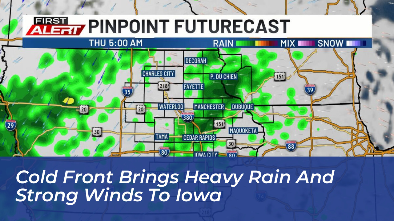

Two active weather systems are delivering heavy rain, strong gusty winds, and the season’s first potential frost to parts of Iowa and south-central Pennsylvania, according to regional forecasts published on October 14, 2026. While eastern Iowa braces for periods of moderate to heavy downpours followed by a sharp drop in temperatures, Pennsylvania prepares for a blustery Friday cold front.
According to forecasts from KCRG, eastern Iowa faces rainfall totals ranging from 0.50 to 1.00 inches, with locally higher amounts expected. Showers began spreading northeast overnight before intensifying into widespread rainfall, particularly during the midmorning and midafternoon hours. Daytime temperatures in Iowa remain unseasonably cool, with afternoon highs struggling to reach the upper 50s to low 60s.
Wind Gusts and Sharp Temperature Drops
Meteorologists note that the primary shift in weather arrives Thursday night as a potent cold front sweeps across the region. Northwesterly winds are projected to strengthen significantly, bringing gusts between 25 and 35 mph on Thursday night, followed by potential 45 mph gusts on Friday.
By Friday, daytime highs across eastern Iowa will hover in the low to mid-50s. The cooling trend will directly impact outdoor evening events, with temperatures during high school varsity football games expected to drop sharply into the 40s.
First Frost and Freeze Warnings Anticipated
Behind the robust cold front, Canadian air will settle into the Upper Midwest. KCRG and the National Weather Service warn that Friday night will bring a significant temperature drop, sending overnight lows plunging into the 30s. This drop introduces the season’s first potential frost to eastern Iowa, with a localized freeze possible, particularly for areas north of Highway 30.
Forecasters indicate that the unseasonably cold air will be relatively brief, with a dry warming trend expected to take over early next week.
Impact on South-Central Pennsylvania
Simultaneously, south-central Pennsylvania is preparing for its own transition driven by the same sweeping weather pattern. Regional forecasts from WGAL highlight that after experiencing unseasonable warmth earlier in the week, Pennsylvania will experience a sharp temperature drop following the passage of the windy Friday cold front.
Residents across both impacted regions are advised to monitor updated local forecasts, secure outdoor holiday or lawn decorations against high winds, and take preliminary steps to protect sensitive outdoor plants from incoming frost.