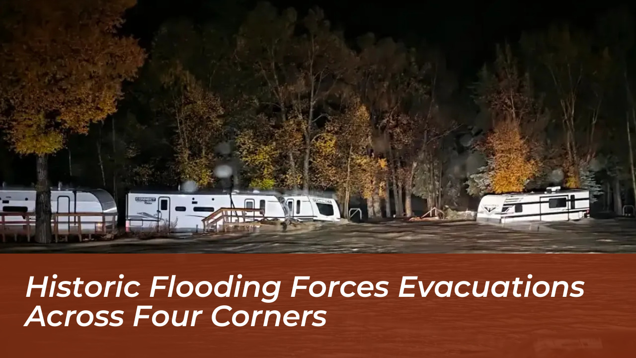

Record rainfall has triggered severe flooding across the Four Corners region of New Mexico, Colorado, Utah, and Arizona. This emergency forced evacuations, damaged homes, and disrupted critical infrastructure. Emergency crews conducted numerous water rescues, including rooftop extractions, as relentless storms prompted disaster declarations and widespread alerts across multiple states.
The severe weather, fueled by Pacific tropical systems and an unusually soggy El Niño pattern, dumped several inches of rain onto an already saturated region. Swollen waterways, particularly the San Juan and Animas rivers, surged to historic and record-breaking heights. They threatened surrounding communities and prompted urgent warnings from local and tribal authorities.
Severe Impacts Felt Across San Juan County, New Mexico
San Juan County, New Mexico, experienced some of the most serious impacts of the multi-state weather crisis. Floodwaters inundated low-lying residential areas, forcing emergency services to execute rooftop rescues and pull residents out of homes surrounded by three to four feet of water.
In Farmington, the largest city in the affected zone, city officials ordered mandatory evacuations for approximately 600 households along the rising San Juan and Animas rivers. Farmington Police Chief Steve Hebbe described the situation during a Friday press briefing as an unprecedented, “once-in-a-generation” event while confirming that no fatalities had been reported at the time.
Infrastructure took a heavy blow as well. The Bloomfield Water Reclamation Plant was forced to shut down after floodwaters compromised the facility, carrying untreated wastewater directly into the San Juan River. Roads, bridges, and local routes across the county were heavily damaged or closed due to washouts and debris.
Colorado Declares Disaster Emergency as Rivers Swell
North of the border, Colorado Governor Jared Polis responded to the escalating crisis by declaring a disaster emergency for 11 counties. The state activated National Guard members to assist local emergency personnel with swift-water rescues and logistics in southwestern Colorado.
In Archuleta County, the Sheriff’s Office issued mandatory evacuation orders for low-lying areas situated along the San Juan, Rio Blanco, Navajo, and Piedra rivers. Pagosa Springs and surrounding communities faced severe roadway washouts, while major flooding was reported along the South Fork Rio Grande near the town of South Fork.
Meteorologists noted that areas with higher elevations, including the rugged San Juan Mountains, absorbed up to six inches of rain over a short period. This overwhelmed natural drainage systems and turned small creeks into raging torrents.
Navajo Nation and Neighboring States Mobilize Resources
Downstream from Farmington, residents across the vast Navajo Nation braced for incoming floodwaters that peaked late Friday and early Saturday. Navajo Nation Deputy Police Chief Donnie Kee urged residents not to delay safety measures during a regional news conference.
“Do not wait to make your evacuations. Make your preparations for yourselves, your families, as well as your animals,” Chief Kee warned.
Emergency responders on the Navajo Nation coordinated high-stakes rescue operations. In Dennehotso, Arizona, the Navajo Department of Emergency Management-working alongside tribal services, the Kayenta Fire Department, and Arizona Department of Public Safety air rescue rangers-deployed an all-terrain specialized vehicle to rescue seven families, totaling 30 people, from flooded homes.
Meanwhile, in southwestern Utah, the city of Hurricane declared a state of emergency after rapid floodwaters and mud poured into neighborhoods, damaging roughly 80 homes and 50 recreational vehicles. Footage shared by local agencies captured residents guiding livestock through muddy waters as cleanup efforts began.
Outlook and Ongoing Safety Risks
Although intense rainfall slowed temporarily by Friday afternoon, emergency officials emphasized that the threat had not passed. Rivers continued to crest at dangerous levels, and National Weather Service forecasters warned that additional thunderstorm activity and persistent flood watches would remain active through the weekend.
Local disaster management teams continue monitoring vulnerable levees, bridges, and evacuation routes. Residents in impacted zones are strongly advised to heed local warnings, avoid traveling on water-covered roads, and remain prepared for long-term recovery efforts as the Four Corners region assesses the full extent of the weather disaster.