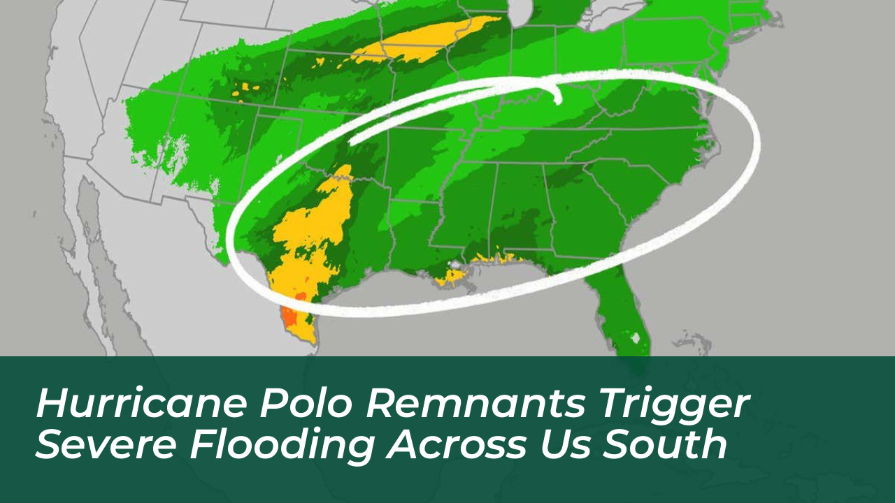
The lingering remnants of Hurricane Polo and Tropical Storm Rachel are driving dangerous rainfall across up to 30 states. This threatens widespread flash flooding throughout the Southwest, Southern Plains, and Southeast through the weekend. Flood watches currently cover nine states. Meteorological forecasts project rainfall rates to exceed 1 to 2 inches per hour.
Hard-hit areas across the Southwest and Plains could receive between 6 to 8 inches or more of precipitation. This heavy influx threatens to rapidly saturate ground that already experienced significant monsoon flooding earlier in the season in states like New Mexico and Arizona.
Severe Risk Zone Spans Over 230,000 Square Miles
A Level 3 out of 4 flash flood risk encompasses more than 230,000 square miles. This zone covers southern and eastern Arizona, New Mexico, southern Colorado, the Texas and Oklahoma Panhandles, and southwestern Nebraska. Meteorologists note that if this risk area were an individual state, it would rank as the third largest in the country, trailing only Alaska and Texas.
Polo’s remnants moving through New Mexico are predicted to generate dangerous wind gusts up to 60 mph. These winds create additional hazards for vulnerable power lines, trees, and rain-soaked soil.
Timeline of the Multiday Flood Threat
- Tuesday: The threat expands into eastern New Mexico, the Texas and Oklahoma Panhandles, and parts of the Central Plains with intense hourly rainfall rates.
- Wednesday and Thursday: Moisture shifts eastward across the Plains and Texas toward the Midwest. It impacts major cities including Dallas, Oklahoma City, Austin, and San Antonio.
- Friday and Weekend: Rain shifts further eastward toward the Gulf Coast and Ohio Valley, bringing additional rounds of heavy precipitation.
Historic Moisture Levels and Safety Guidance
The atmospheric moisture driven by these Pacific tropical systems is nearing or surpassing historical records for late September across the Southwest, Texas, and Oklahoma. Dry washes, slot canyons, burn scars, and urban low-lying areas remain particularly susceptible to sudden, life-threatening inundation.
Emergency management officials and the National Weather Service remind residents to heed local warnings and adhere strictly to safety protocols. Never attempt to drive across flooded roadways, as vehicles can be swept away in mere minutes. Turn around, don’t drown.