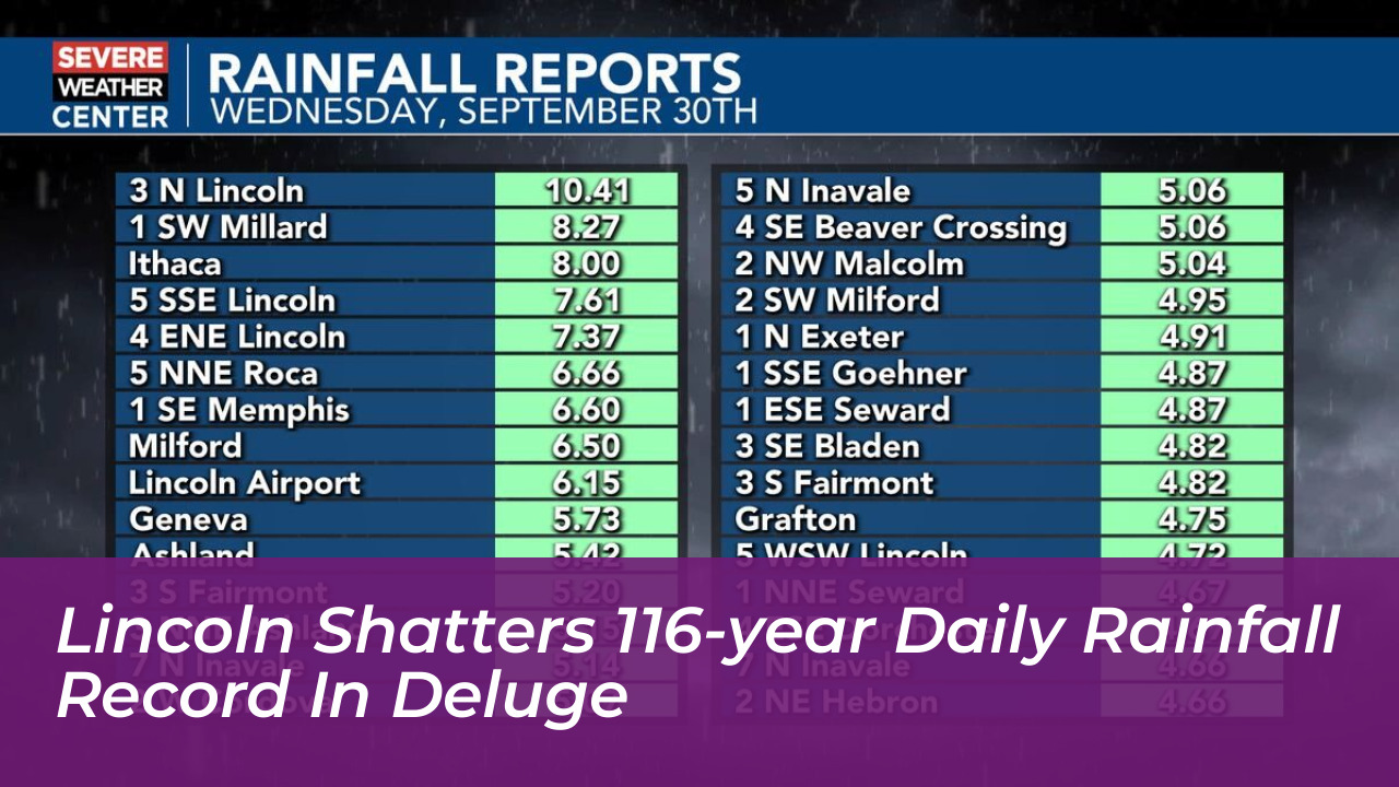
A historic and torrential downpour smashed a 116-year-old rainfall record at the Lincoln Airport on Wednesday, September 30. A total of 6.15 inches of rain inundated southeastern Nebraska. The staggering volume set an all-time daily high for the area and triggered widespread flooding risks throughout the city and surrounding counties.
According to reports from KOLN, the previous daily precipitation record of 5.45 inches had stood since August 29, 1910. The severe weather system drastically altered local climate statistics, pushing Lincoln’s total September rainfall to an unprecedented 11.49 inches. This massive accumulation officially makes it the wettest September ever recorded in the city’s history, as well as its fourth wettest month overall.
Widespread Regional Impacts Across Southeastern Nebraska
The record-breaking weather system delivered broad precipitation totals ranging from 1 to 4 inches across southern and southeastern Nebraska. However, the most intense weather bands dropped between 4 and 8 inches of rain.
Meteorologists noted that the heaviest corridor of the storm stretched:
- From Hebron through Seward and Saline Counties
- Directly into Lincoln and northwestern Lancaster County
- Eventual eastward expansion toward the Omaha metropolitan area
Local emergency management teams reported localized flash flooding, overflowing creeks, and hazardous driving conditions along major transit routes as drainage systems struggled to keep pace with the sudden deluge.
Historical Context of Lincoln Climate Extremes
Precipitation extremes in Lincoln have historically been tied to intense summer and early autumn convective storms. Weather observations in the area date back well over a century. Official modern precipitation monitoring has been anchored at the Lincoln Airport station since the 1970s, following previous station locations within the city center.
While severe thunderstorms are common in Nebraska during the transition from summer to fall, an event of this magnitude-bringing over six inches in a single 24-hour window-remains an exceptionally rare meteorological occurrence. The combination of saturated grounds and the sheer volume of rainfall pushed local river basins and urban infrastructure to their limits. This prompted continuous monitoring by local weather forecasters and hydrologists.