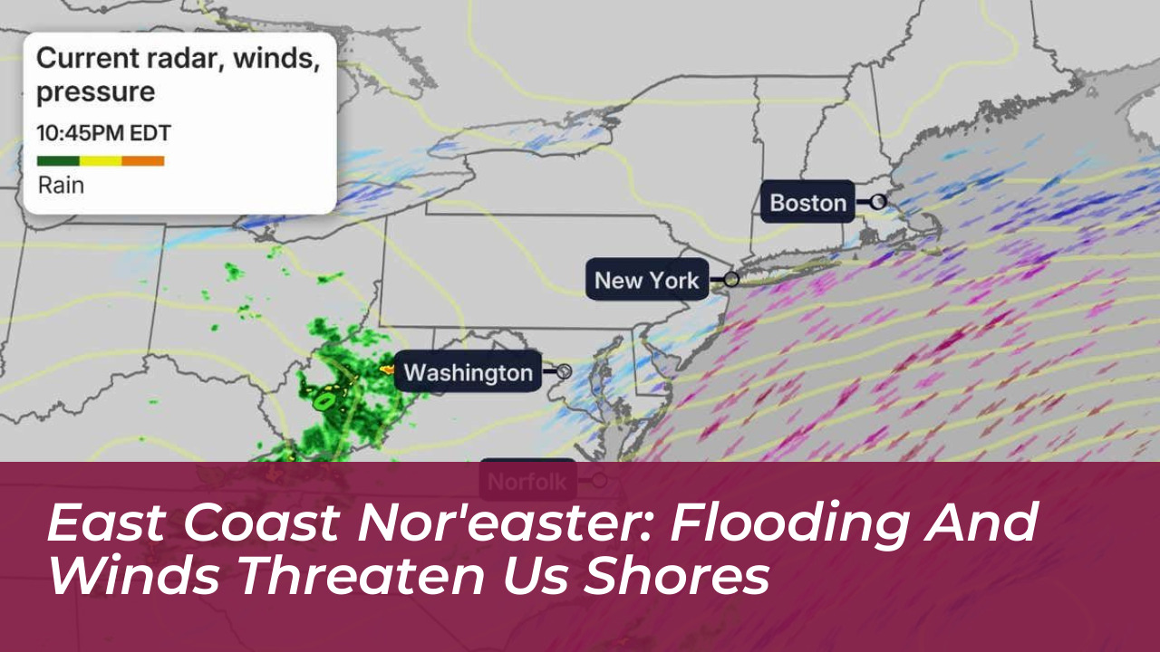
A powerful early-season nor’easter is currently churning along the United States East Coast, creating severe disruptions from North Carolina to New England. This intense low-pressure system is channeling gale-force winds, torrential rainfall, and destructive storm surges directly into coastal communities. Unlike late-fall or winter nor’easters that typically drop heavy snowfall, this event features exclusively heavy rain combined with astronomical tides. Meteorologists warn that the storm will maintain its grip through multiple high-tide cycles, threatening vulnerable shorelines, critical infrastructure, and transportation networks from the Outer Banks up to Maine.
- Understanding the Early-Season Nor’easter Impacting the East Coast
- Coastal Flooding and Storm Surge Severity
- Wind Gusts and Infrastructure Damage
- Regional Breakdown: Impacts From North Carolina to New England
- North Carolina Outer Banks
- Mid-Atlantic and Chesapeake Bay
- New York Tri-State Area and New Jersey
- New England
- The Role of the Full Moon in Amplifying Tides
- Transportation and Travel Disruptions
- Safety Guidelines and Emergency Preparedness
- Frequently Asked Questions
- Why is this September storm classified as a nor’easter?
- How long will the coastal flooding persist?
- Is snow expected anywhere from this system?
- What should drivers do if they encounter flooded roads?
- How can homeowners protect property from storm surge?
Understanding the Early-Season Nor’easter Impacting the East Coast
Nor’easters derive their name from the strong northeasterly winds that blow in from the Atlantic Ocean and sweep across coastal states. These storms form when cold continental air masses clash with warm, moist air streaming northward from the Gulf Stream. While these intense low-pressure systems are synonymous with winter blizzards, experiencing one in September is notable. The primary catalyst for this system is a stationary low-pressure center hovering just offshore, which continuously pumps moisture onshore.
Because trees retain full foliage in September, the saturated ground combined with high wind gusts creates an elevated risk for widespread tree failures and power grid disruptions. The combination of heavy leaf cover and soaked topsoil makes root systems extremely vulnerable to leverage from persistent gale-force winds.
Coastal Flooding and Storm Surge Severity
The National Weather Service has issued comprehensive coastal flood warnings spanning hundreds of miles of coastline. The most severe inundation is occurring from the northern Outer Banks of North Carolina through the Jersey Shore and into the Delaware and Chesapeake Bays. Water levels are surging 2 to 4 feet above normal astronomical high tides in many areas, with localized spots experiencing deviations approaching 6 feet.
In southeastern Virginia, water becomes trapped at the lower end of the Chesapeake Bay, causing severe backups along tidal rivers in Norfolk, Virginia Beach, and Newport News. In downtown Norfolk, Smithfield, and Suffolk, street-level flooding has rendered multiple roadways impassable during peak high tides, stranding vehicles and halting emergency service access in low-lying sectors.
Communities along the Jersey Shore face similar challenges as seawater overtops dunes and floods coastal neighborhoods. Local emergency management teams have deployed high-water vehicles to assist residents trapped in flooded homes. Municipal pumping stations are operating at maximum capacity to drain storm runoff, but high tides continually stall progress.
Wind Gusts and Infrastructure Damage
Destructive winds are accompanying the coastal surge, with maximum sustained speeds and severe gusts threatening property and electrical grids. Wind gusts exceeding 50 mph have been clocked from southern Cape Cod down through Long Island, coastal New Jersey, and the Delmarva Peninsula. High wind warnings remain active for southeast New England, including Boston and Providence, where gusts could reach up to 60 mph.
These persistent winds are snapping tree limbs, uprooting trees in saturated soils, and triggering widespread power outages across Massachusetts, Rhode Island, Maryland, and coastal New Jersey. Utility companies have mobilized crews, but restoration efforts face continuous delays while high winds persist and block access routes.
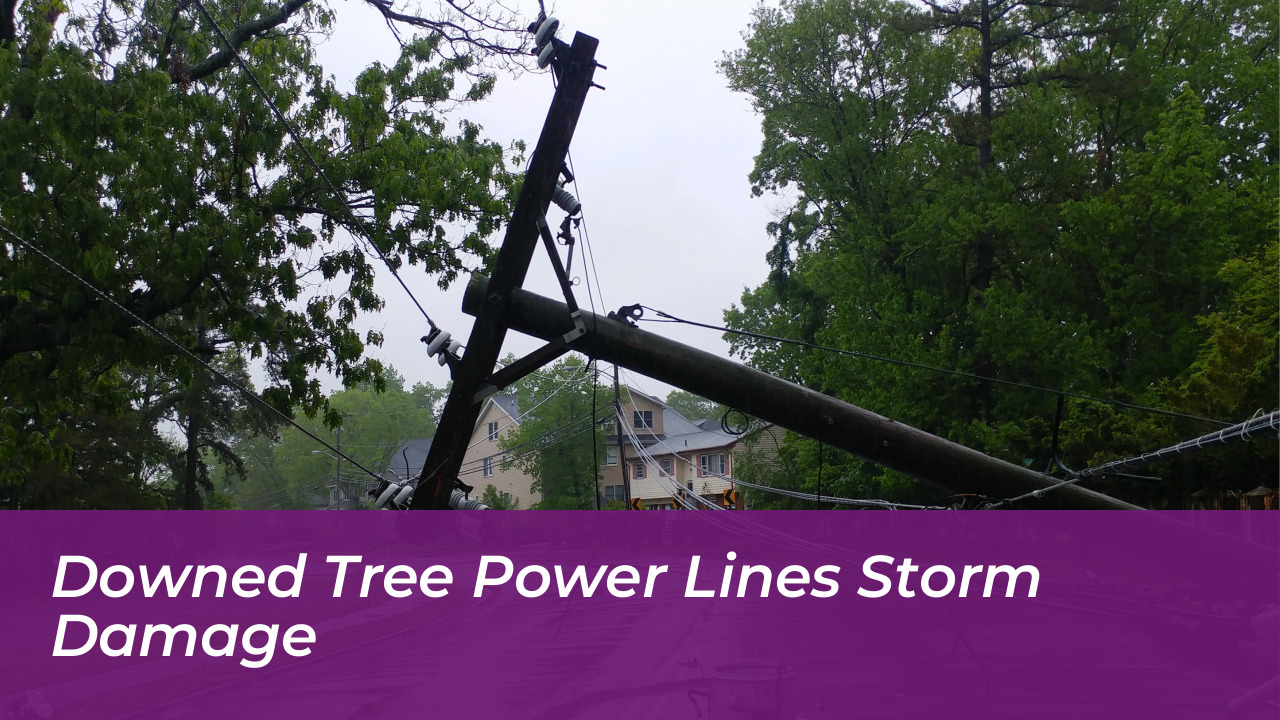
Power outages are impacting hundreds of thousands of residential and commercial customers across the affected region. Traffic signals are dark in numerous municipalities, creating hazardous conditions at major intersections. Public works departments urge drivers to treat disabled traffic lights as four-way stops.
Regional Breakdown: Impacts From North Carolina to New England
The geographic footprint of this nor’easter covers multiple distinct regions, each experiencing unique hazards:
North Carolina Outer Banks
Severe ocean overwash forced the total closure of a 16-mile stretch of North Carolina Highway 12 in Dare County, stretching from Sea Oats Drive to Oregon Inlet Road. High surf and extreme beach erosion continue to threaten coastal properties and infrastructure.
Mid-Atlantic and Chesapeake Bay
Tidal backups are inundating urban centers in Virginia and Maryland. Rising water levels forced the cancellation of major outdoor events, including the Oceans Calling festival in Maryland, as safety officials prioritized public protection.
New York Tri-State Area and New Jersey
Major coastal flooding plagues Atlantic City and Long Island shores. Beach erosion is reaching extreme levels along the South Jersey coast, while urban street flooding impacts low-lying areas and transit terminals.
New England
Persistent rainfall and strong gusts are lashing Rhode Island, eastern Massachusetts, coastal New Hampshire, and southern Maine. Flash flooding is a primary concern in urban centers like Boston due to blocked storm drains and steady downpours.
The Role of the Full Moon in Amplifying Tides
The severity of this coastal flooding event is significantly worsened by astronomical factors. The storm’s peak impacts coincide directly with the weekend full moon, generating some of the highest monthly astronomical tides. This synergy between the storm surge and spring tides prevents normal drainage during low tide cycles, trapping water in bays, estuaries, and tidal rivers.
Consequently, minor to moderate coastal flooding is repeating across multiple consecutive high tides, extending the duration of property exposure to corrosive saltwater and pounding surf. Infrastructure that normally drains between tidal cycles remains submerged for extended periods.
Oceanographers track these spring tides closely because they push water levels past typical flood thresholds. Low-lying coastal real estate experiences repeated inundation twice daily until the offshore system finally weakens and moves away.
Transportation and Travel Disruptions
Infrastructure networks across the Northeast corridor are experiencing significant disruptions due to flooded roadways, downed power lines, and high winds. Major aviation hubs, including Boston Logan International Airport and the three primary New York City airports (JFK, LaGuardia, and Newark), face rolling flight delays and cancellations.
Major airlines have issued weather waivers allowing passengers to alter travel plans without penalty. Motorists are urged to avoid driving through standing saltwater, as hidden road washouts and saltwater corrosion pose severe hazards to vehicles and mechanical components.
Commuter rail lines, including MTA services in New York and MBTA operations in Boston, report minor delays due to debris on tracks and localized flooding near coastal terminals. Ferry services across Long Island Sound and Boston Harbor remain suspended until wind and sea conditions improve.
Safety Guidelines and Emergency Preparedness
Authorities advise residents and visitors in affected zones to adhere strictly to local emergency directives to protect life and property.
- Stay away from ocean beaches, jetties, and seawalls, where powerful rip currents and sneaker waves can sweep individuals into the surf.
- Never drive or walk through flooded roadways. Just six inches of moving water can knock down an adult, and two feet of rushing water can carry away most vehicles.
- Secure outdoor furniture, trash cans, and temporary structures that could become projectiles in high winds.
- Prepare for extended power outages by charging communication devices, securing backup lighting sources, and stocking non-perishable food and potable water.
Frequently Asked Questions
Why is this September storm classified as a nor’easter?
A nor’easter is defined by the direction of its winds. Any low-pressure system off the East Coast that generates persistent winds blowing from the northeast toward the shore meets the meteorological criteria, regardless of the calendar month.
How long will the coastal flooding persist?
Coastal flooding will continue through multiple high-tide cycles into the weekend and early next week. While wind speeds will gradually diminish by Sunday afternoon, residual water trapped in bays and river basins will take longer to recede completely.
Is snow expected anywhere from this system?
No snow is associated with this system. Because this event is occurring early in the season, atmospheric temperatures are far too warm for frozen precipitation, resulting exclusively in heavy, wind-driven rainfall.
What should drivers do if they encounter flooded roads?
Turn around immediately and find an alternative route. Saltwater is extremely corrosive to automobile electrical systems, and deep water can stall engines or sweep cars away.
How can homeowners protect property from storm surge?
Move valuable items to higher floors, seal basement entry points with sandbags, and ensure sump pumps possess working battery backups before rising water arrives.