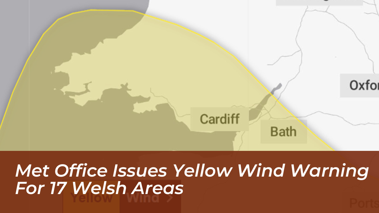

The Met Office has issued a yellow weather warning for wind across 17 local authority areas in Wales. This alert comes as a deep area of low pressure moves across the United Kingdom. Forecasters warn that damaging gusts could reach up to 70 mph in exposed coastal locations. This brings a heightened risk of property damage, travel disruption, and potential danger to life from flying debris.
Which Welsh Areas Are Affected by the Warning?
The yellow weather warning covers large parts of south, west, and mid Wales, encompassing 17 local authority regions. The alert runs from midnight until midday on Friday. It brings strong west to northwesterly winds alongside periods of heavy rain.
The local authority areas included in the Met Office warning are:
- Cardiff
- Newport
- Swansea
- Bridgend
- Vale of Glamorgan
- Rhondda Cynon Taf
- Caerphilly
- Blaenau Gwent
- Merthyr Tydfil
- Torfaen
- Monmouthshire
- Neath Port Talbot
- Carmarthenshire
- Ceredigion
- Pembrokeshire
- Powys (including south Powys, Brecon, Builth Wells, Crickhowell, and parts of Bannau Brycheiniog National Park)
- Aberystwyth and surrounding west coast areas
Expected Disruption and Weather Conditions
Inland areas can widely expect wind gusts ranging between 50 mph and 60 mph. Exposed coastal locations and elevated terrain are projected to see speeds peak at 70 mph or higher. However, the Met Office notes that some uncertainty remains regarding the exact track of the strongest winds.
Alongside the severe gales, periods of heavy rainfall will compound difficulties for motorists and commuters. The weather agency has outlined several potential impacts:
- Property and Structural Damage: A slight chance that buildings could suffer damage, including roof tiles being blown off properties.
- Travel Delays: Longer journey times and potential cancellations affecting road, rail, air, and ferry services. Vulnerable roads and bridges may face possible closures.
- Power Outages: A risk of disruption to electricity supplies, which could also temporarily affect mobile phone coverage and other local services.
- Coastal Hazards: Large waves throwing beach material onto seafronts, coastal roads, and nearby properties. This prompts warnings for beachgoers and dog walkers to stay clear of cliffs and turbulent water.
Safety Advice for Residents
“Strong west to northwesterly winds may spread across southern parts of England and Wales on Friday. Gusts of 50-60 mph are possible and some coastal or exposed areas could see 70 mph or more, but at this time there is uncertainty in where the strongest winds will be,” a Met Office spokesperson said.
Residents living within the 17 affected regions should secure loose items around their properties before the weather deteriorates. These items include garden furniture, bins, trampolines, and fences. Travelers are encouraged to check transit conditions ahead of time. Households should also prepare basic emergency supplies, including torches, batteries, and mobile power packs, in the event of local power cuts.
Conditions will remain breezy throughout Friday, though meteorologists anticipate that the strongest winds will begin to ease from late morning into the early afternoon.