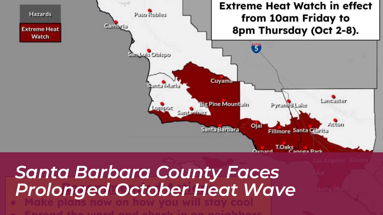
A prolonged fall heat wave is bringing dangerously high temperatures to much of Santa Barbara County starting Friday, Oct. 2, 2026. Elevated heat is expected to persist through mid-October, according to the National Weather Service. Meteorologists from the Oxnard office indicate that this upcoming weather pattern could develop into one of the longest heat waves recorded this season.
Extreme Heat Watch Details and Timeline
Weather officials issued an Extreme Heat Watch extending from 10 a.m. Friday through 8 p.m. Thursday, Oct. 8, 2026. The advisory covers key areas, including:
- Santa Barbara
- Goleta
- Surrounding South Coast communities
- The Cuyama Valley
Forecast models indicate that coastal temperatures could reach up to 85 degrees Fahrenheit. Meanwhile, mountain zones and the Cuyama Valley may peak near 100 degrees Fahrenheit. Ryan Kittell, a meteorologist with the National Weather Service’s Oxnard office, noted that while the official watch stretches through October 8, the heat will likely last longer into the middle part of the month.
Regional Temperature Breakdown
Different parts of the county will experience varying degrees of intensity during the multi-week warm spell:
- Santa Barbara: Daytime highs around 90 degrees with nighttime lows around 70 degrees from Saturday through at least Tuesday.
- Goleta: Slightly cooler conditions with highs in the mid-80s.
- Santa Ynez Valley: Highs in the low-90s and overnight lows around 60 degrees starting over the weekend.
- Santa Maria and Lompoc Valleys: Expected to reach the mid- to high-80s with nighttime lows hovering around 60 degrees, allowing them to potentially escape the absolute worst of the heat.
Wildfire Risks and External Weather Factors
Dry conditions and low humidity levels throughout the stretch are raising significant concerns among meteorologists regarding fast-moving, plume-dominated wildfires. Even without an official Red Flag Warning in immediate effect, the combination of dry brush and high daytime temperatures creates a high-risk environment.
Additionally, offshore activity from Hurricane Rachel is expected to influence ocean currents. This activity may bring high tides and minor rainfall chances to parts of Southern California early next week, despite the hurricane itself remaining far off the coast.
County Safety Guidelines and Recommendations
The Santa Barbara County Office of Emergency Management issued critical safety tips to help residents stay safe during the high-temperature event:
- Hydration: Drink plenty of cool, non-alcoholic beverages without sugar or caffeine. Do not wait until you are thirsty.
- Vulnerable Populations: Check on elderly neighbors, young children, and pets who cannot easily monitor or react to high-temperature dangers.
- Outdoor Activity: Limit strenuous outdoor activities to cooler morning and evening hours. Wear sunscreen and rest often in shaded areas.
- Heat Illness Recognition: Know the signs of heat exhaustion (dizziness, nausea, heavy sweating) and heat stroke (hot, flushed skin, lack of sweating, life-threatening symptoms requiring immediate 911 calls).
- Vehicle Safety: Never leave children or pets unattended in vehicles, as internal temperatures can reach deadly levels within minutes.