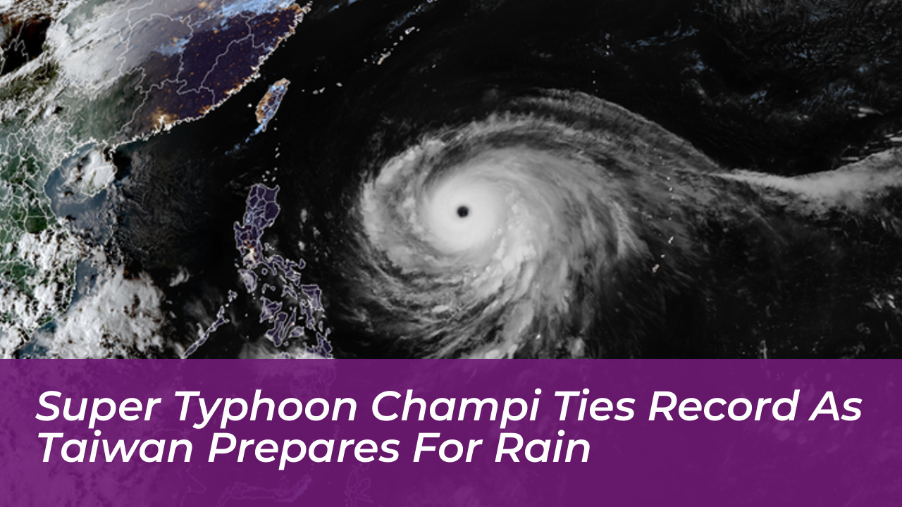

Super Typhoon Champi has rapidly intensified over the western Pacific, ranking among the strongest tropical cyclones recorded worldwide in 2026. While regional authorities continue to monitor its precise track, forecasters in Taiwan predict an earlier northward turn that should spare the island from a direct landfall, though heavy rainfall is still expected across northern and eastern regions.
The Central Weather Administration (CWA) in Taiwan reported that Champi reached sustained winds of 198 kilometers per hour near its center, with gusts peaking at 245 kilometers per hour. CWA forecaster Cheng Chieh-jen indicated that a weakening Pacific high-pressure system has altered the storm’s projected trajectory, making an earlier northward turn near Japan’s Ishigaki Island increasingly likely.
Typhoon Timeline and Expected Warnings
As the massive storm system moves across the western Pacific, meteorological agencies are closely watching its progression. According to current projections, the CWA could issue a sea warning as early as Wednesday night or Thursday morning, followed closely by a land warning on Thursday evening or Friday.
Data from the CWA places the storm’s destructive wind radius at approximately 250 kilometers. Although the system is expected to track away from Taiwan by Sunday or Monday, its outer bands will bring hazardous weather conditions to the region well before then.
Impact on Taiwan: Heavy Rain and Temperature Drops
The most pronounced impacts on Taiwan are forecast for Friday and Saturday. The CWA warns that northern Taiwan, along with Yilan and Hualien counties, could experience heavy to extremely heavy rainfall during this period. Showers are expected to linger in areas north of Taoyuan into early next week.
In addition to heavy precipitation, the storm’s approach coincides with a strengthening northeast monsoon. Unseasonably warm temperatures reaching 34 degrees Celsius early in the week are expected to plummet sharply, bringing daytime highs down to 23 to 25 degrees Celsius in northern Taiwan by Wednesday before temperatures begin to rebound on Sunday.
Regional Monitoring and Aviation Advisory
International forecasting bodies, including the Japan Meteorological Agency (JMA), have tracked Champi’s evolution into a powerful system. Aviation stakeholders and regional travelers should monitor weather advisories closely. High waves, destructive winds, and torrential downpours could prompt flight disruptions across the Sakishima Islands and surrounding air corridors as the system advances.
Emergency management teams across northern and eastern Taiwan remain on standby as officials update forecasts to reflect the shifting high-pressure ridge governing the typhoon’s path.