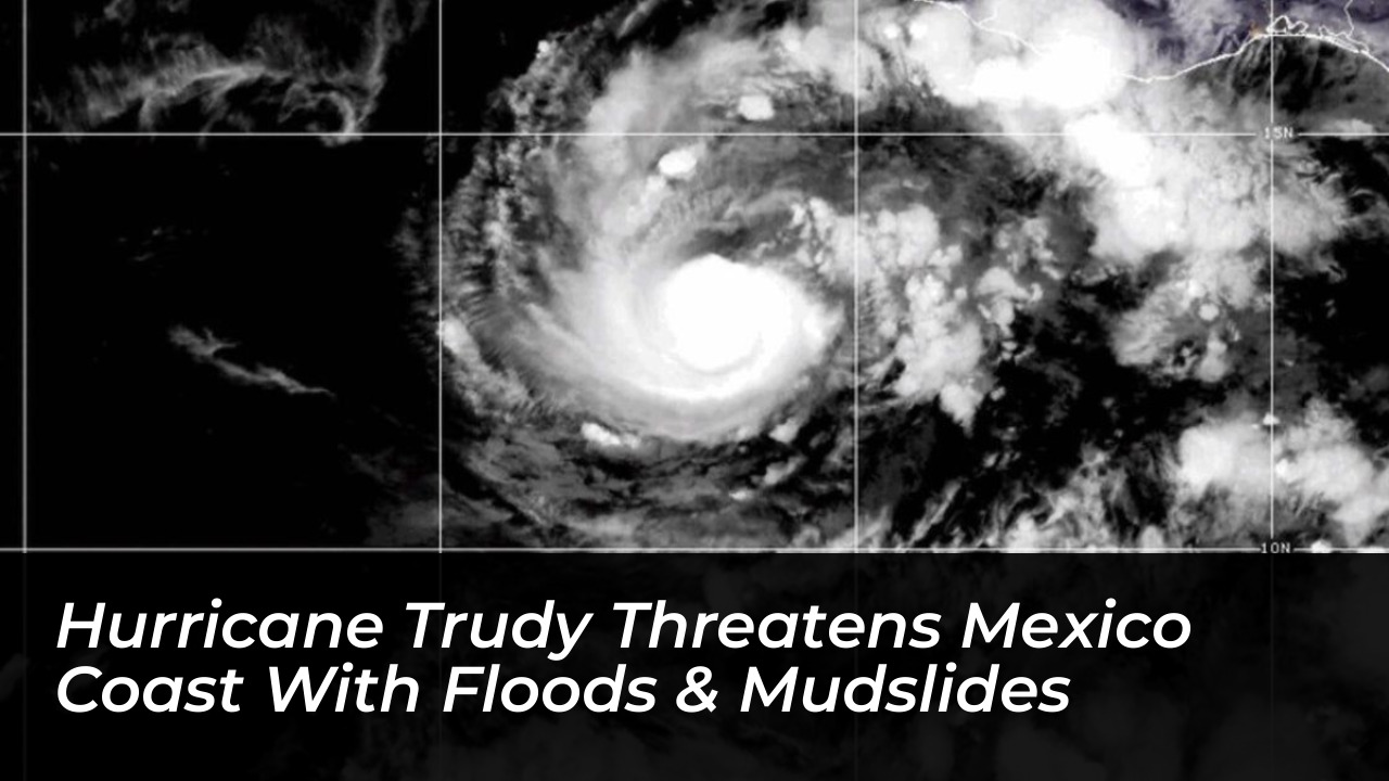

Heavy rainfall and hurricane-force winds threatened Mexico’s Pacific coast on Sunday, October 18, 2026, as Hurricane Trudy moved northwest offshore. This prompted urgent warnings of potentially life-threatening flooding and mudslides. The U.S. National Hurricane Center (NHC) warned residents across the western states of Michoacán, Colima, and Jalisco to prepare for dangerous conditions because successive tropical systems left the ground heavily saturated.
According to National Hurricane Center updates, Trudy was classified as a Category 2 hurricane carrying maximum sustained winds of 105 mph (165 kph). The storm system was located approximately 135 miles west-southwest of Manzanillo, tracking northwest at a speed of 10 mph (17 kph). The center of the storm was expected to remain near the Mexican coastline through Sunday evening before eventually tracking south of the Baja California Peninsula.
Active Warnings and Regional Impacts
A formal hurricane warning remained in effect stretching from Manzanillo in Colima state northward to Cabo Corrientes in Jalisco. Additionally, authorities maintained a tropical storm warning for Las Islas Marias, while previous weather alerts for the coastline east of Punta San Telmo to Lazaro Cardenas were officially discontinued.
- Jalisco: Coastal areas including Puerto Vallarta and Cabo Corrientes faced severe squalls, elevated storm tides, and potential transport interruptions along Federal Highway 200.
- Colima: Authorities monitored Manzanillo, Mexico’s primary Pacific container port, for high swells, maritime closures, and urban drainage overflows.
- Michoacán: Steep mountain terrain created high vulnerability to catastrophic mudslides along local highway cuts connecting Lázaro Cárdenas and Playa Azul.
The Mexican Navy (SEMAR) and local civil protection agencies urged mariners and coastal residents to exercise extreme caution due to hazardous high waves, heavy downpours, and the constant risk of rising rivers and localized landslides.
Rainfall Projections and the Danger of Saturated Soils
Meteorologists emphasized that wind speed classifications masked the true severity of the threat. With local soils already soaked by multiple storms earlier in the season, including Hurricane Simon, Trudy was projected to deliver substantial rainfall accumulations.
Forecasters estimated widespread rainfall totals of 4 to 8 inches (10 to 20 centimeters) through the weekend. Isolated peak totals were projected to reach up to 12 to 15 inches (30 to 38 centimeters) along and near the coastal terrain of Michoacán, Colima, and Jalisco. The NHC noted that the combination of slow forward speed and steep topography creates an orographic lift effect. This effect supercharges local downpours and rapidly turns mountain ravines into fast-moving debris torrents.
Infrastructure and Emergency Response
Regional airports, including Puerto Vallarta International Airport (PVR) and Manzanillo’s Playa de Oro International Airport (ZLO), remained on high alert for ground stops, wind shear advisories, and turbulent approach corridors. Civil protection authorities advised travelers and residents to avoid non-essential travel on mountain highways during active downpours to prevent entrapment from sudden rockfalls and flash floods.
The 2026 Eastern Pacific hurricane season has proven exceptionally relentless, setting high records for accumulated cyclone energy driven by elevated sea surface temperatures. As emergency stockpiles thin across affected municipalities, local governments continue to coordinate disaster response protocols to manage the immediate aftermath of Trudy’s threat.