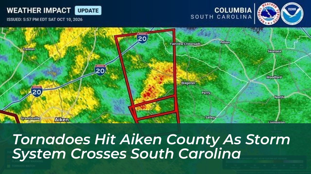

Multiple tornadoes swept across South Carolina on Saturday, Oct. 10, as the remnants of Hurricane Isaias combined with a low-pressure system moving up the East Coast. The severe weather outbreak impacted several regions, with confirmed tornado tracks and storm damage reported across Allendale, Barnwell, and Aiken counties.
According to the National Weather Service in Columbia, the severe weather developed from supercell thunderstorms that produced a continuous series of brief tornadoes along a northward-moving path. Matthew Gropp, a meteorologist with the National Weather Service in Columbia, noted the unusual duration and frequency of the storm cells.
“In those situations, we get tornadoes that develop along a path, super cell thunderstorms, that can produce brief tornadoes,” said Matthew Gropp, a meteorologist with the National Weather Service in Columbia. “In this case it was a big example. It started down in Allendale County, we had storm chasers on it, and it went through Barnwell. Eventually it moved into Aiken County, just north of Willison, and tracked through the central part of Aiken County.”
Tornado Track and County Impacts
The severe weather system triggered a lengthy sequence of alerts. Gropp stated that roughly 12 tornado warnings were issued for a single thunderstorm as it tracked from Allendale County northward into Lexington County. A little after 6 p.m., the National Weather Service confirmed a tornado on the ground in Aiken County near Camp Rawls Road, moving from Willison toward Kitchings Mill, New Holland, and Interstate 20.
Prior to reaching Aiken County, the storm caused verified damage in neighboring jurisdictions. In Barnwell County, a dispatcher with the Barnwell County Sheriff’s Office confirmed that power lines and utility poles were knocked down near S.C. Highway 37 and Freedom Road, leaving traffic signals inoperable. In Burke County, Georgia, drone footage reviewed by meteorologists revealed structural damage to multiple buildings along Story Mill Road, with roofs torn off and at least one structure flattened, though no injuries were reported there.
In Screven County, a confirmed tornado downed trees in a 200-yard path near Old Savannah Highway and Highway 21. Meanwhile, Allendale County recorded a confirmed tornado south of Appleton moving northward at 30 mph.
Power Outages and Property Damage
Utility providers across the region reported widespread disruptions throughout Saturday. Dominion Energy and Aiken Electric Co-Op dispatched crews to address outages across their respective service territories. By evening, hundreds of customers across the affected counties were left without electricity.
Rainfall totals across Aiken County were significant, with weather stations logging between 2 and 5 inches of rain, prompting a flood watch from the National Weather Service for Aiken, Edgefield, and Barnwell counties.
Meteorologists indicated that the tornadoes likely ranged in intensity from EF-0 to EF-2 on the Enhanced Fujita scale. An EF-0 rating features wind speeds of 65 to 85 mph capable of minor roof damage and broken tree limbs, while an EF-2 brings 111 to 135 mph winds capable of destroying mobile homes and uprooting large trees. National Weather Service survey teams deployed on Sunday, Oct. 11, to evaluate the structural damage and finalize wind speed determinations.
Community Disruption and Event Cancellations
The severe weather prompted the postponement or cancellation of numerous weekend events across the region. Gaston Market Day was rescheduled for Oct. 31, while Cedar Creek’s Art in the Park and the Boondocks Farms Farmers Market and Vendor Festival in Jackson were postponed to Oct. 17. Additionally, outdoor activities including a butterfly stroll in Hitchcock Woods, Aiken Music Fest at Highfields Event Center, and an open house at the Graniteville-Vaucluse-Warrenville Fire Department were called off due to safety concerns.
Forecasters confirmed that conditions would improve rapidly following the passage of the front. Sunday’s forecast brought clearing skies, high temperatures in the mid-70s, and calm conditions, allowing recovery and utility repair operations to proceed without further weather interruptions.